|
|
Status
|
Construction scheme
(completed)
|
|
Contractor
|
FP McCann
|
|
Scheme
|
New
single-carriageway link road connecting
the A42 Broughshane Road to the A26
Larne Road, Ballymena. |
|
Total
Length
|
2.3 km / 1.4 miles
(of which 1.4 km / 0.9 miles is entirely
new road and the remainder is an upgrade
of existing roads)
|
|
Dates
|
2007 - Ministry of
Defence deem St Patrick's Barracks to be
surplus
2011 - Land handed
over to NI Executive
25 Nov 2016 - Draft St Patrick's
Barracks Masterplan published
Oct 2017 - Demolition of existing
barracks began
Late Feb 2020 - Site
clearance work began at both ends of the
scheme
29 Apr 2021 - scheme
went out to tender (closing date 3 June)
27 Apr 2022 - tender
for construction awarded to FP McCann
Late May 2022 - work
began
16 June 2023, 4.15pm -
road opened to traffic
|
|
Cost
|
£5.8m (construction
cost only) as of May 2022
|
|
See
Also
|
Draft St Patrick's Barracks
Masterplan - DFC
|
Click here to jump
straight down to updates for this scheme.
St Patrick's Barracks
in Ballymena was originally occupied by the Army
but has lain empty since 2011. The site contains
a large area of land close to Ballymena town
centre and its development has been the subject
of a masterplan produced by the Department for
Communities and Mid and East Antrim Council. The
component of the plan that interests us is the
proposed new link road that will traverse the
site connecting the A26 Larne Road to the south
with the A42 Broughshane Road to the north. The
new road will be 2.3 km long, of which 0.9 km is
a re-use of sections of existing road and 1.4 km
of which is entirely new road. The map below
shows the proposed route. The red line shows the
entirely new part of the road while the yellow
lines show existing roads that will be re-used.
The green lines show other external road links
that are planned for the site, but which
technically aren't part of the St Patrick's
Barracks Link Road.
Updates
21 Jun 2023: The new St Patrick's
Barracks link road opened to traffic at 4.15pm
on Friday 16 June! A planned public event the
day of the opening was cancelled as a mark of
respect due to a life lost in the local area.
Traffic appeared to be slow to discover that the
road was opened, as some of the first drivers
reported pedestrians walking down the middle of
the road at first! Dave
Sweeney was the first to post a video
of driving along the road, taken about two
hours after opening! The video starts at the
south end of the road, on Larne Road Link, and
continues to Broughshane Road roundabout. It
then turns round and goes back to Larne Road
Link. Many congratualtions to FP McCann, Amey
and all their sub-contractors for a great job! I
have marked the scheme as "completed" as it is
completed from the point of view of the
travelling public, though completion works may
carry on for a few more weeks.
7 Jun 2023: Five days ago (on 2 June) I
was given a tour of the site by the main
contractor FP McCann and designers Amey. I spent
a couple of hours with several people from the
team. We walked the southern half of the scheme
looking at vartious things. I thoroughly enjoyed
it, and learned quite a few new things, some of
which are included in the captions below. So
thank you to you all! For clarity, the photos
are arranged in order from north to south.
People interested in the road should be aware
that on 16 June people will be allowed
to walk the full length of the road ahead of its
official opening, which should happen later this
month. With thanks to Stephen Livingston and Ian
Hunter for sending me information.

Pic 1: 2 June 2023 Aerial view looking south rom
the north end of the scheme, with the access
road to Ecos heading off to the left. The fenced
area to the right of the road ahead is shown in
more detail in pic 4. The road sports double
yellow lines along its entire length. [Wesley
Johnston]

Pic 2: The "old" bit of Kernohan's Lane seen
from above on 2 June 2023. I discovered that
this has been retained mainly to provide a
parking area for people accessing the Ecos
Nature Park, rather than due to a need to adjust
the curvature of the road. [Wesley Johnston]

Pic 3: As the road is built on a flood plain,
the scheme includes an area of compensatory
flood storage. When the Braid floods, water from
the river (which is on the right here) flows
through the pipes and then under the road in the
culvert shown.... 2 June 2023 [Wesley Johnston]
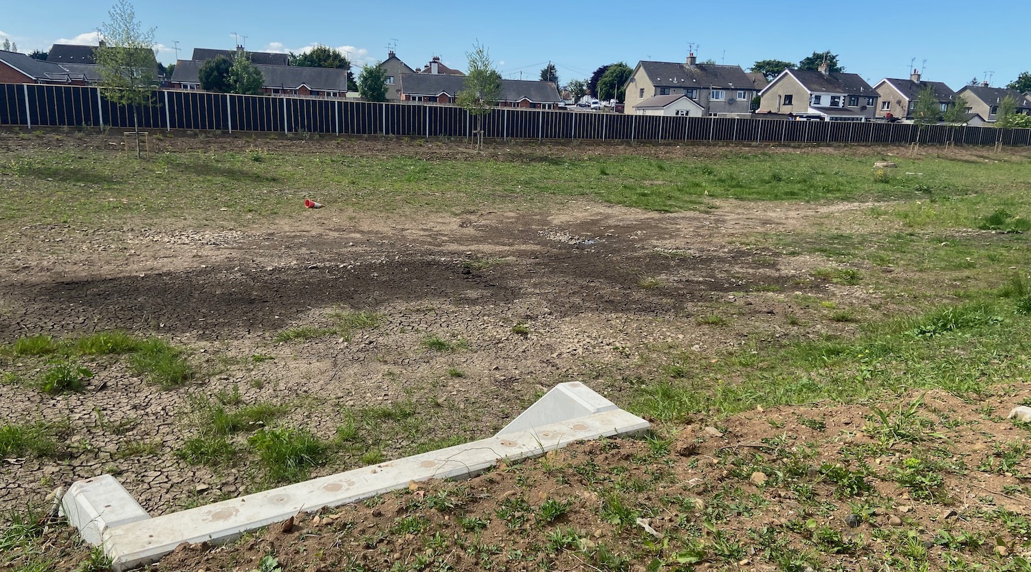
Pic 4: ... and out the other side into this
large depression (also visible in pic 1). It has
already been partially filled several times
since the road was built. It remains here until
the flood subsides and then it exits the same
way it entered. Due to this feature, overall the
flood plain has the same capacity it did before
the road was built. 2 June 2023 [Wesley
Johnston]

Pic 5: Looking across the new road to the new
access road that leads to Suffolk Street, 2 June
2023. Importantly, I was told that this will
only provide through access for pedestrians and
cyclists as there will be bollards preventing
vehicular access. It also provides access to the
new Northern Regional College building which is
being built on the left. [Wesley Johnston]
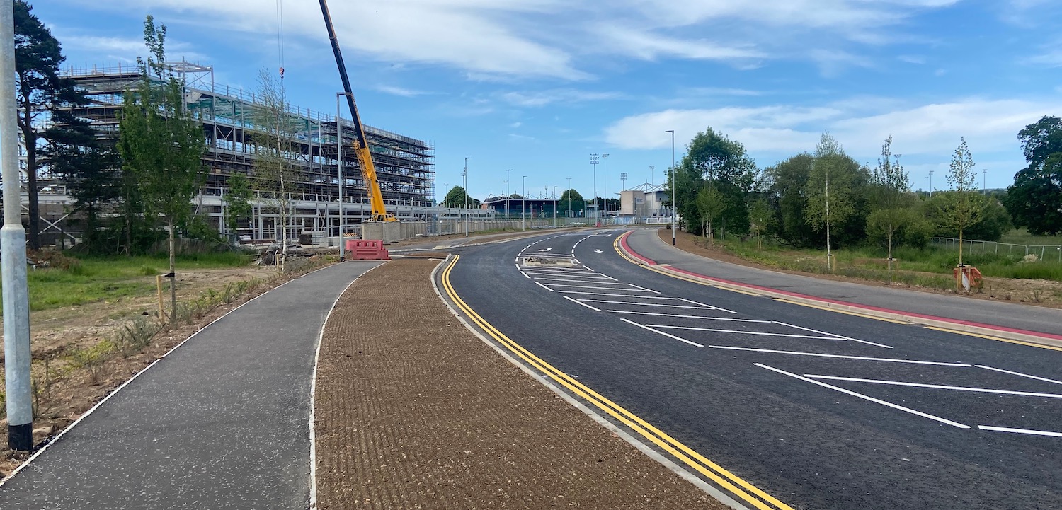
Pic 6: View north along the scheme from further
south on 2 June 2023. This bit of the road is
finished with grass sown on the soil here, and
native trees and shrubs now planted on the left.
The footway on the right has been given a red
strip to indicate that it is a shared
cycle/footway. [Wesley Johnston]

Pic 7: Drainage channel being installed at the
base of a slope on on 2 June 2023. The pipe is
is perforated to let water in and is covered
with a layer of gravel. The idea is that water
running off the slope will soak into the gravel
and hence into the pipe, rather than washing
across the footway. [Wesley Johnston]

Pic 8: View south from near Castle Tower School
on 2 June 2023. You don't appreciate from the
air how much the road rises up at this point to
go over the side of a small hillock (which has a
rath at the summit). Social housing is now being
built on the right here. There is a lot of steel
barrier on the left here due to a slope down
towards the river. [Wesley Johnston]

Pic 9: A new puffin crossing adjacent to Castle
Tower School seen the day after it was fitted,
on 2 June 2023. The red tactile paving contrasts
with the tan coloured tactile paving that is
used at non-signalised crossings. [Wesley
Johnston]

Pic 10: Aerial view of the south end of the
scheme on Larne Road Link on 2 June 2023. Signal
heads have now been installed and the lights are
due to go live within the next week. Before that
happens, the line painters will come out to
finalise the road markings here. [Wesley
Johnston]
17 May 2023: We continue to be spoiled
for images of this scheme. This time there are
four photos taken by the contractor FP McCann,
and reproduced here with their permission (thank
you). Work appears to be progressing very well
and FP McCann have confirmed that the road is
scheduled for completion next month, in line
with the original timetable of twelve months.

Starting at the south end of the scheme, this is
the future T-junction of the new road with the
A26 Larne Road Link. It's not clear from this
image whether the junction will be signalised,
but the islands would certainly be right for a
controlled junction. 17 May 2023 [FP McCann]
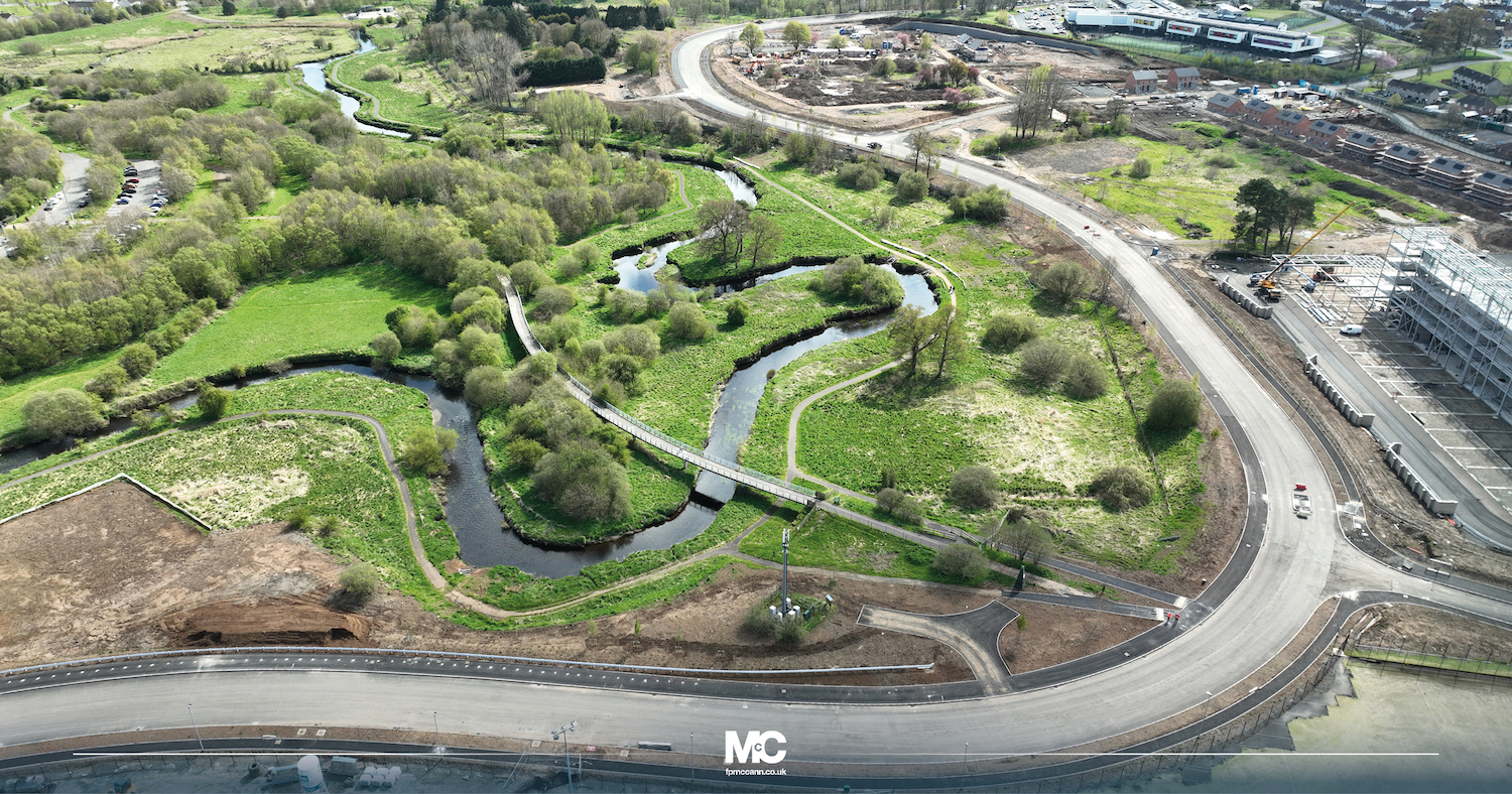
View south along the new road from beside the
new Northern Regional College Campus and
existing footbridge over the Braid River. The
road surface seems to be complete here. Note
what appears to be an access road and turning
head for a mobile phone mast in the foreground.
17 May 2023 [FP McCann]

Moving further north, this is the view south
along the new road from its junction with the
existing Kernohan's Lane (left) which leads to
the Ecos Centre. Work here seems to be focused
on the footways. 17 May 2023 [FP McCann]

View of the footway along the east side of the
new road near Northern Regional College, which
has yet to get its final course of tarmac. Note
also the crash barriers on the right which
prevent errant vehicles going down the bank or
entering the Braid river. The width of the
footway suggests it may be marked out as an
adjacent cycle way and footway. 17 May 2023 [FP
McCann]
10 May 2023: A very quick update to
share another drone
video of the new road this time taken by
Fossie's Drone Adventures. It was taken on 28
April and shows part of the road being used by
vehicles, as described in the previous update
below. You can see at 0:40 the loop of the
former Kernohan's Lane at the north end of the
scheme is to remain in place, with a turning
head at one end. I am not sure why, as there are
no vehicular accesses from it. Perhaps it is to
retain access to utilities beneath?
28 Apr 2023: Another quick update to
share dashcam
footage shared by Ian Hunter (thank you)
of the northern half of the road actually open
to traffic, taken on Monday this week. This part
of the road still has quite a bit of work to do,
so it appears to be open purely to preserve
access to the showgrounds while work is carried
out on other accesses. Still, it's a tantalising
milestone to be able to take a vehicle along
even part of the road. Ian has kindly provided
the below commentary on the video:
- 0.13 New alignment diverges from
original. Redundant formation in course of
removal on the left (that pesky lamp post [see
photo in update for 6 April below] is still
there!)
- 0.28 Access to remaining original
alignment, to be repurposed as car parking.
- 0.41 Revised access to ECOS Park with
amended priority.
- 1.30 Entrance to Showgrounds Car Park,
limit of public access.
The remainder of the video is the same route in
reverse.
6 Apr 2023: This update is to share three
photos of the northern end of the scheme, where
the road connects to the A42 Broughshane Road. At
this end there was an existing local road
(Kernohan's Lane) which made a very tight 90° turn
(see map above). The upgraded road will soften
this curve (click here for a map),
so in the pictures below you can see the new
alignment and the old alignment. It looks as if
part of the old road on the corner will remain in
situ, accessed by a short link. Perhaps the
intention is to use it as a layby, or perhaps to
preserve access to services or somesuch. The
pictures are all by Ian Hunter, as well as useful
information from the scene - thank you! Completio
is expected by the end of May and that seems
plausible with the progress I'm seeing.
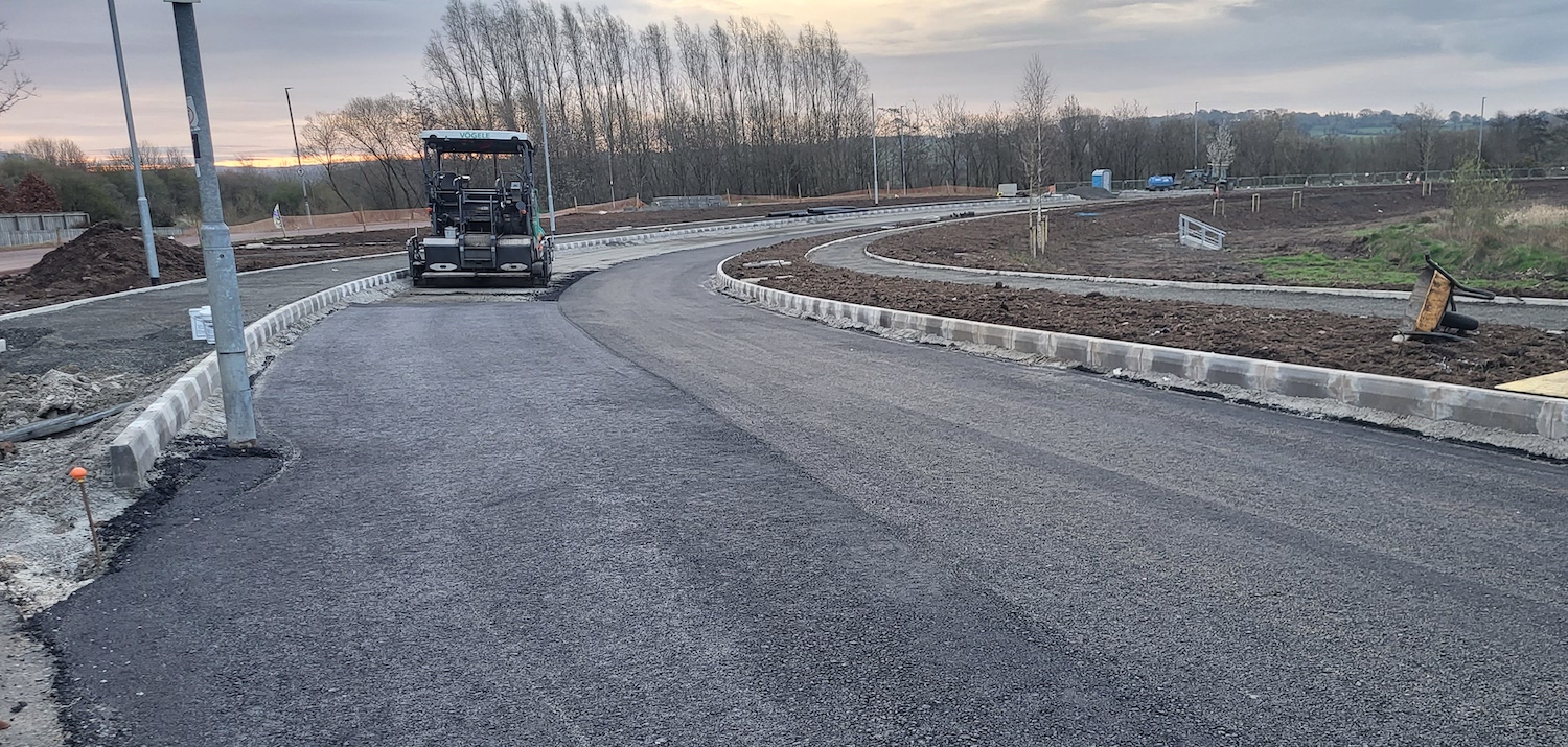
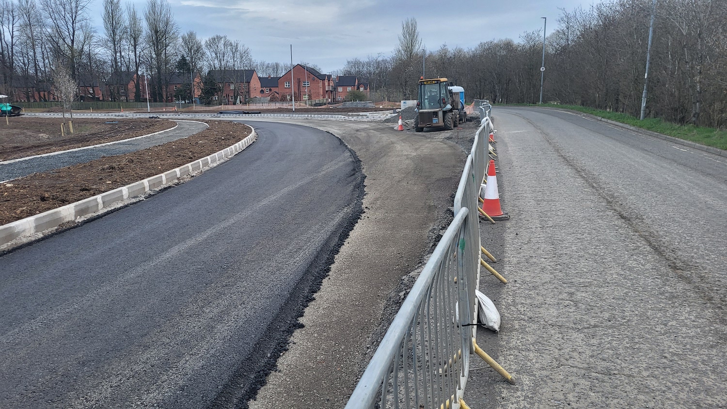
View SE along the new alignment of road on 4
April 2023 with blacktop being laid. The old
alignment of Kernohan's Lane is off to the left.
The lamp post belonged to the older road and
will be removed before the road opens (I hope!)
[Ian Hunter].
Similar location to the previous shot, but
moving left a bit. The "old" road is on the
left, and in the foreground there is what
appears to be a turning head. This suggests that
the old road will remain as a cul-de-sac rather
than being removed. 4 Apr 2023 [Ian Hunter]
Looking the other direction (north) from further
along, this is the point where the new road
(left) rejoins the alignment of the "old" road
(right). This
is roughly the same view before work began. 4
Apr 2023. [Ian Hunter]
22 Mar 2023: Another drone
video is available, published by Fossie's
Drone Adentures – thank you! This one was filmed
on St Patrick's Day, 17 March. The brief
commentary below relate to the timings in the
video in minutes and seconds:
- 0:10 The video begins at the Suffolk Street
connection and then turns left (north
- 0:40 Along this whole stretch past the
Braid the base courses of tarmac appear to be
donw, with the final wearing course still to
be added. The footways appear completed though
it's hard to tell from the height.
- 0:48 What appears to be a new flood
attenuation pond. These collect runoff from
storm events and release it slowly so as not
to overwhelm local watercourses.
- 0:55 Realignment taking place where the road
passes the entrance to the Ecos Hub. Active
tarmac laying is taking place here.
- Video then turns round and heads south
again.
- 2:40 Southern end of the scheme is at a
similar stage with base course laid.
- 3:00 Work actively taking place on the
connection to Larne Road Link.
- Remainder of the video focuses on the new
campus of Northern Regional College.
10 Mar 2023: This update is just to link
to another drone
video, published on 28 February 2023 by
Kieran Mayo. The video starts at the south end
of the scheme at Larne Road Link and ends at the
northern end, on Broughshane Road, following the
banks of the river Braid. As you can see work is
very well advanced at the central part of the
scheme, and is actively underway at the south
end. Work at the northern end seems less
advanced. The whole project is due for
completion during May. With thanks to Ian Hunter
for alerting me to this video.
8 Feb 2023: Progress over the past three
months has been excellent. Fossie's Drone
Adventures has just put up a new
aerial video of the scheme taken on 28
January 2023. The video goes from north to
south, but starts a little distance along the
scheme, near to the Ecos Centre. In the video
you can see that the kerb lines are in place
along about two-thirds of the scheme now, and
that street light columns are also in place. A
portion of the road near Ballymena Showgrounds
has now had tarmac added (see photo below by Ian
Hunter). It looks like the contractor is laying
the blacktop from the north/centre of the scheme
towards the south. The brief commentary below
relate to the timings in the video in minutes
and seconds:
- 0:26 View south with Ecos Centre off frame
to the left.
- 0:36 Tarmac-ed stretch with the Showgrounds
to the right.
- 1:15 New connecting road to Suffolk Street
visible on the right. The main road here has
kerbs and street light columns.
- 2:03 T-junction for link road to connect to
Demesne Avenue on the right, not yet built.
- 2:50 Southern section of road with kerbs and
street light columns here too.
- 3:00 Terminus of the scheme at Larne Road
Link. This short stretch is an existing road
which will be widended. These works appear to
be ongoing now, especially on the right close
to Larne Road Link.
The scheme appears to be making good progress,
so I am still expecting it to open around June
2023, though the contractor FP McCann has not
said anything on this point.
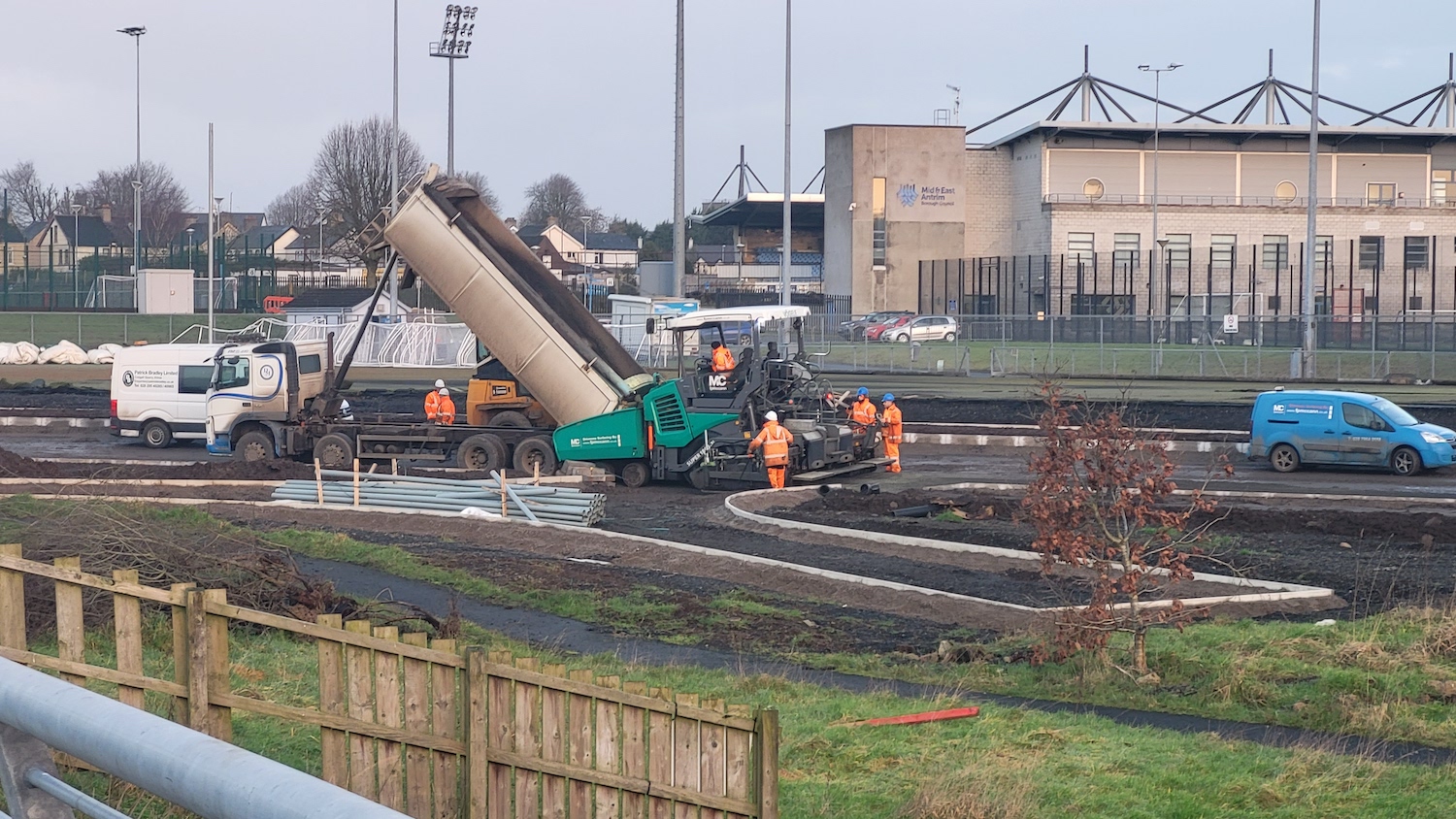
Blacktop being laid on the new road at the
Showgrounds on 31 January 2023. [Ian Hunter]
9 Nov 2022: The project, in time terms,
is now approaching the half way point with six
months almost done another six months estimated
to go. Fossie's Drone Adventures has just put up
a new
aerial video of the scheme, beginning at
the north end, heading south and then returning
north again. It was taken four days ago on 5
November. The main takeaways from this video are
that the earthworks for the road itself are very
well advanced, with long lengths of embankments
looking completed, and that drainage works are
well underway. There are trenches on each side
of the future road into which plastic pipes are
being laid. These will then be connected to
drains along the sides of the road. The very
start and very end of the video show where the
road meets the existing Kernohan's Lane, and the
right bend here is being smoothed out. The first
photo below was taken by Ian Hunter (thanks
again!) and shows this area from ground level.
Site clearance works took place here in
September and since then the earthworks have got
underway. The second video shows some of the
earthworks from ground level. All in all, the
scheme seems to be going well and to schedule.
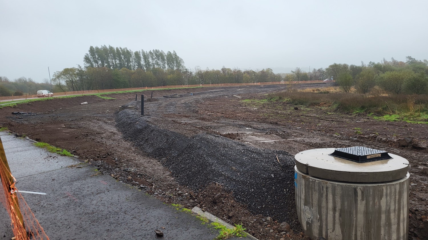
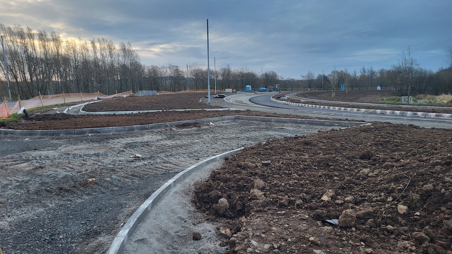
View from Kernohan's Lane at the north end of
the scheme (roughly here)
on 5 Nov 2022, showing earthworks getting
underway the future realigned road which will
smooth out the bend here. The height of the
future road can be judged from the manhole cover
in the foregound. The gravel likely marks the
location of a drainage channel along the side of
the road. [Ian Hunter]
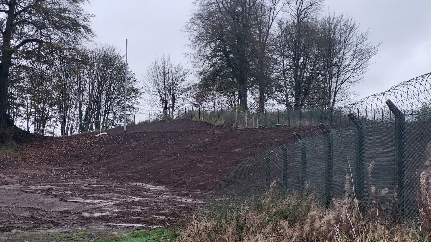
Earthworks visible from behind Castle Tower
School, near the south end of the scheme on 7
Nov 2022. Note the lamp post mast already in
place, minus the light fitting itself. The road
here runs a couple of metres above the school
ground level. [Ian Hunter]
14 Oct 2022: Work is continuing to
progress and the site seems fairly busy now,
with works evident at almost all parts of the
scheme. Firstly, there is an aerial
video of the whole scheme taken by
Fossie's Drone Adventures, taken in late
September. The video starts near the north end
of the scheme at Kernohan's Lane and continues
south to near its southern terminus at the
cinema. Work initially focused on culverts but
in more recent months has focused on the heavier
earthworks which are now largely complete. The
land here is very soft, being the alluvial banks
of the river Braid, which means that the road
base requires geotextile mats to be laid at the
base of the foundations. These are then covered
with a layer of stone, a task which has now been
completed on a little over 50% of the route.
These mats stabilise the soil and prevent the
road surface shifting and breaking up. See photo
below. The contractor, FP McCann, recently
posted some
magnificent aerial photos of the scheme,
as well as a 'newsletter' for people interested
in the scheme. This month work will begin on
linking the new road through the cinema grounds
to Larne Road Link. Work has also been taking
place over the past couple of weeks at the
northern end of the scheme. The picture below
shows some of the works from ground level.
Completion is still estimated for May 2023.
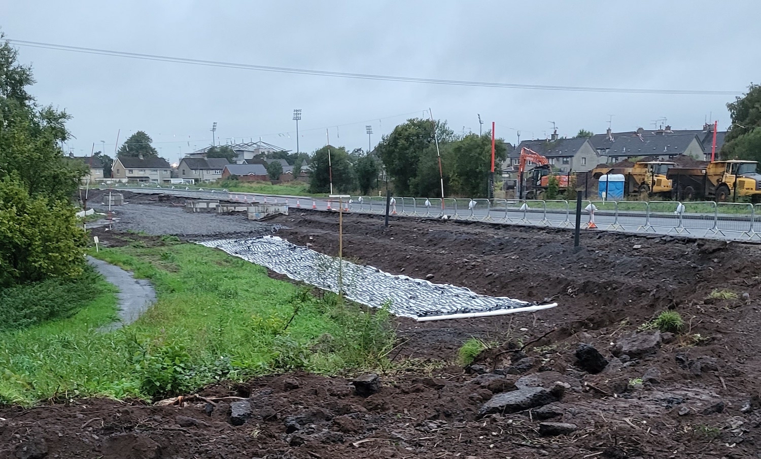
Good shot of the various layers being involved
in building the new road, seen here near
Ballymena Showgrounds at the north end of the
scheme on 30 September. The bare earth is first
excavated, then two layers of geotextile are
laid - a continuous white roll, followed by
bands of the black material. This, in turn, is
then capped with a layer of gravel to provide a
stable base for the road. The road surface
itself will then be constructed on top of this.
The houses are on Fisherwick Crescent. [Ian
Hunter]
22 Sep 2022: A couple more photos, taken
once again by Ian Hunter - thank you! The first
shows a shallow cutting being excavated for the
new road as it passes Tower school. The second
shows recent vegetation clearance at the north
end of the scheme. Vegetation clearance work
took place here in Feb 2020, just before Covid,
and in that time it had re-grown to quite an
extent, so the clearance had to be repeated.
Work has now been underway on the scheme for
four months. Estimated completion is May 2023.
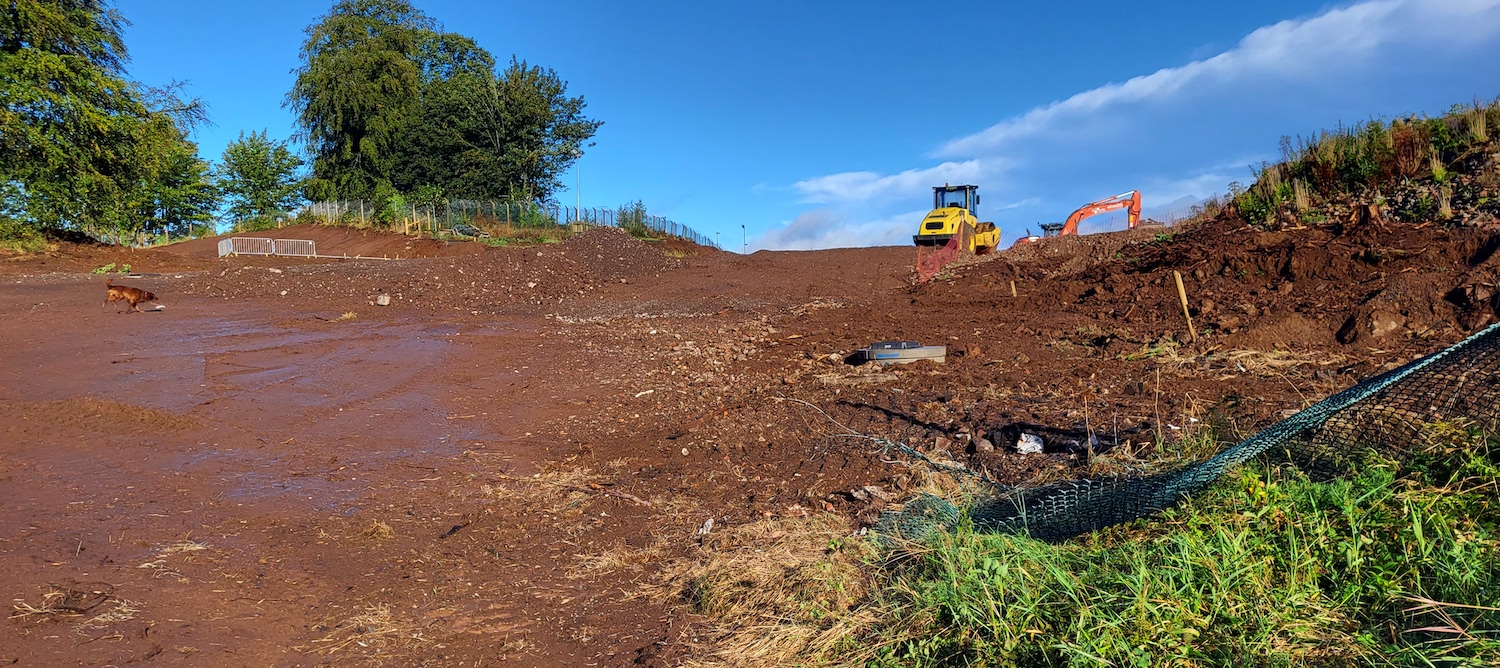
Earthworks underway for a shallow cutting next
to Tower school, 4 Sep 2022. [Ian Hunter]
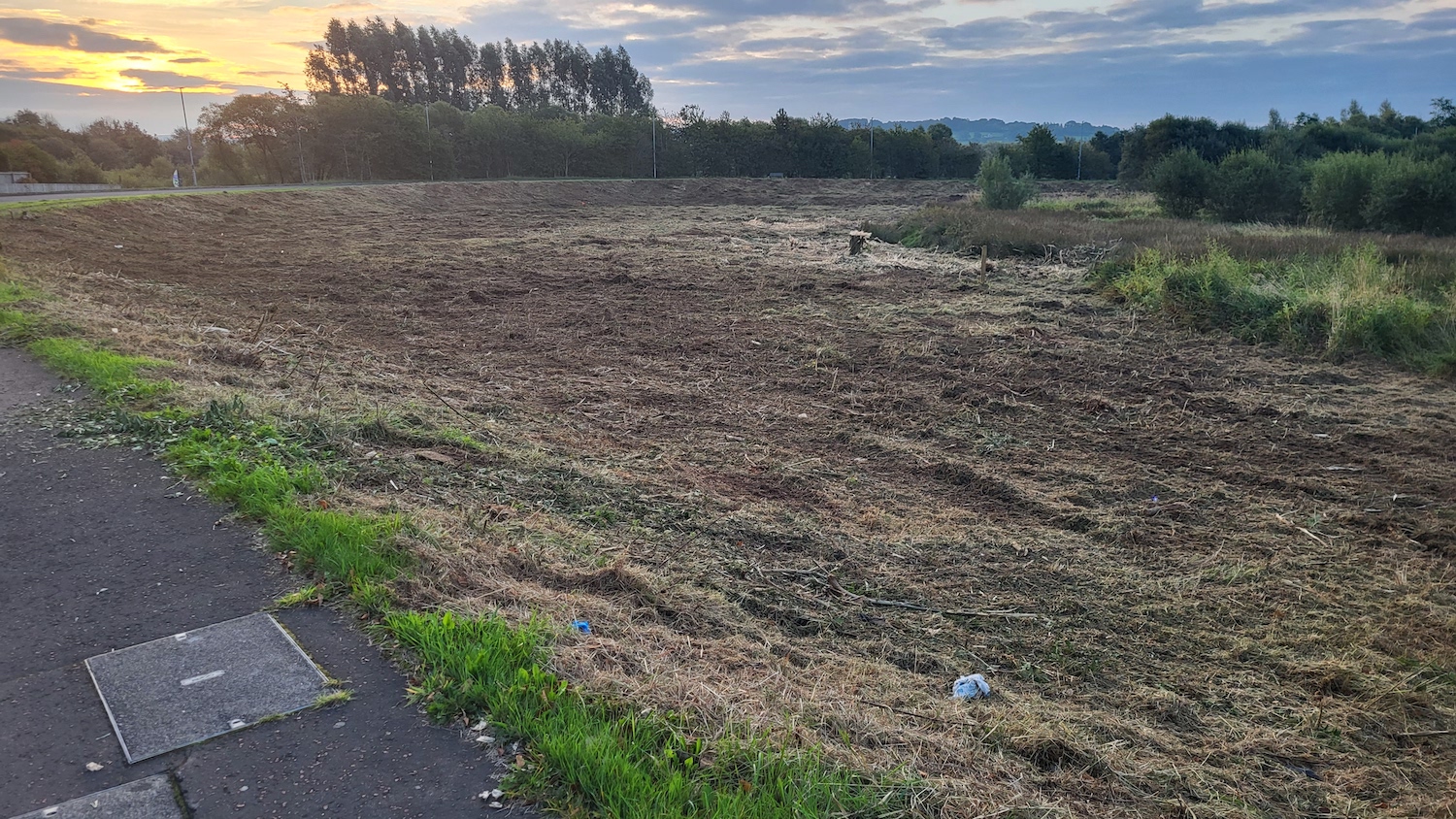
The north end of the scheme on 21 Sep 2022 after
the second set of vegetation clearance work.
There is an existing road here but it is due to
be rebuilt on a shallower curve through the area
ahead - see map in the update for Feb 2020
below. [Ian Hunter]
24 Aug 2022: A brief update to link to
another drone
video of the scheme, posted by Fossie
(thank you). The video shows progress over the
past month, though work doesn't seem to be
progressing at a huge pace. The video is focused
on the central part of the scheme, near the Ecos
Centre, and shows a section of earthworks with
geotextile fabric placed on top of it. There is
a series of black pipes along this embankment
(see 2:00 in the video), which might be vertical
drains, or might simply be markers. Elsewhere
there are telltale signs that new culverts
across the line of the road have been completed
and buried (eg 3:55). A lot of work still to be
done over the coming autumn and winter.
24 Jul 2022: Work is now well underway
on this scheme. To date the focus has been on
earthworks and culverts, and in particular a
section of new road that connects the
showgrounds to the Barracks site. This stretch
will be particularly useful to the contractor
moving heavy plant around the site. The
ground-level photos below were taken by Ian
Hunter (thank you) with two more posted
on Twitter recently by the contractor, FP
McCann. Finally, Fossie has posted drone footage
of the scheme taken on 9 July here.
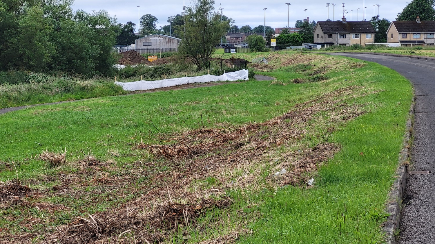
North end of the scheme near Kernohan's Lane on
7 July. The white fencing is typically used to
protect watercourses from silt being washed off
work sites. [Ian Hunter]
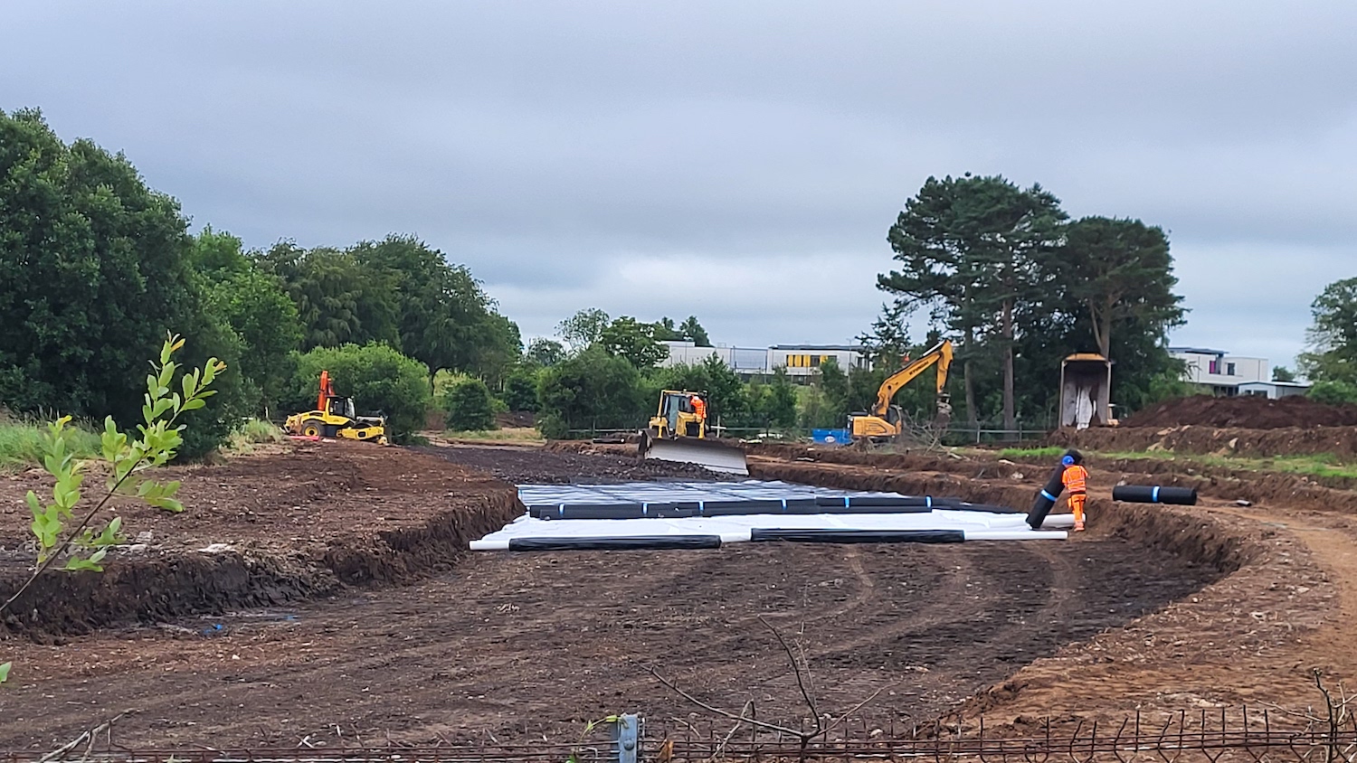
Geotextile being laid on the central section of
the new road near the showgrounds on 7 July.
Geotextile is used on soft ground to provide a
firmer base for the road. [Ian Hunter]
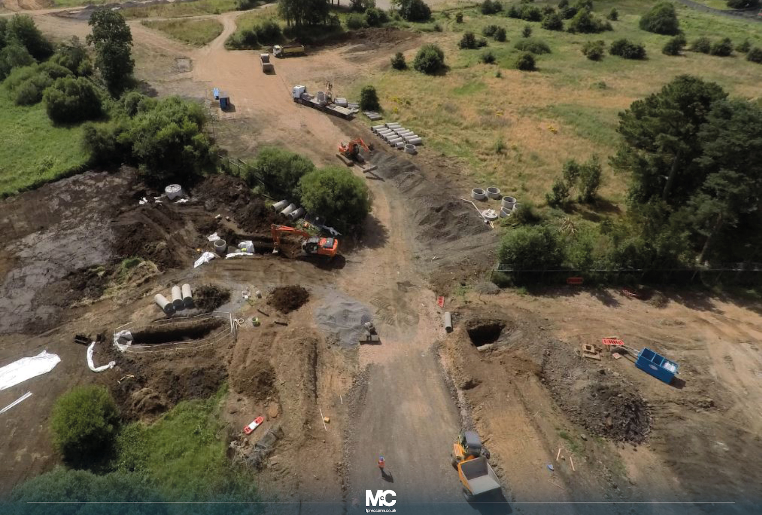
Culvert works underway on the route of the new
road on 23 July. These are used to carry
watercourses under the new road. [Image by FP
McCann]
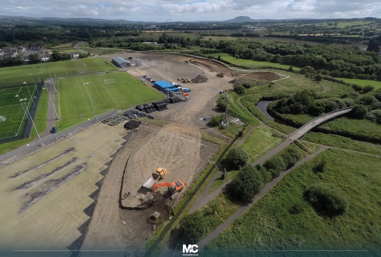
Aerial footage of works underway on the scheme,
including a former sports field, on 23 July. The
geotextile pictured above was being laid in the
area of road visible in the middle distance
here, now buried under more earth. [FP McCann]
25 May 2022: In the previous update I
said we may see movement on this scheme before
mid June, and so it has proved with contractor
FP McCann establishing a site yard at the site.
They also ran a public information event today.
There is a lot of work going on in the vicinity
of the new road, but these appear to be for a
separate project and are unrelated to the road
scheme. Hopefully we will see some concrete work
beginning shortly.
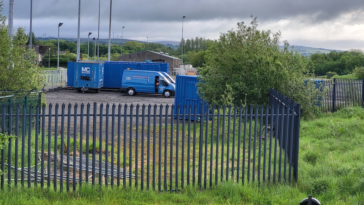
FP McCann site yard taking shape on 23 May 2022
[Anonymous contributor].
15 May 2022: After being out to tender
for over a year, the construction contract was
finally awarded
on 22 April 2022, to FP McCann (congratulations
to them) who were one of five tenders received.
The total value of the contract is £5.8m,
slightly less than the £6m estimated by DFI when
it went out to tender. There is no sign of work
commencing at the time of writing, but
contractors to generally want to get started
fairly soon after an award so we may well see
some movement over the next month. FP McCann
themselves posted
an update about the scheme, which gives a good
bit more information about the plan as well as a
road layout plan. The total construction period
is due to last twelve months. Although work has
not yet begun, I am moving the project to "under
construction" due to the tender award. According
to site visitor Ian Hunter, some of the rubble
from the demolition that took place during 2020
was used to create an embankment along part of
the road which has been fitted with vertical
drains. This is normally done where land is soft
and the embankment fill needs time to settle, so
this was likely planned well in advance to allow
the road works to commence without delay. Tree
clearance was also completed in 2020, so there
are no issues with the bird nesting season.
5 May 2021: A major milestone last week
- the scheme went out
to tender on 29 April. Contractors do not
have long to submit their responses, with a
deadline of 3 June 2021. As expected, the
construction period is expected to be 12 months.
I would expect to see a contractor appointed by
mid summer with work likely to get underway
before the autumn. This timescale would see the
road completed by autumn 2022.
22 Mar 2021: At long last we seem to be
edging closer to construction. DFI's "future
tenders" list is saying that the
construction tender will be released during
March 2021, or perhaps shortly after. The tender
value is estimated to be £6m, at the higher end
of the £4-6m cost estimated. Once awarded,
construction would be expected to get underway
fairly quickly. If the contract were to be
awarded in summer 2021, then it could be
complete and open by mid 2022. We shall wait and
see.
27 Feb 2020: Planning permission was
granted for the scheme back in March 2019, and
site clearance works seem to have got underway
in the past couple of weeks at both ends of the
scheme. As this work involves tree-felling it is
important that it takes place ahead of the bird
nesting season. The photos below are all by Ian
Hunter (thank you) who also alerted me to the
fact that work is underway. I can't locate the
tender for the scheme, but as it's being led by
the Department for Communities rather than the
Department for Infrastructure I may have just
missed it. It's also not clear whether this site
clearance is a separate contract, or whether
work on the road itself will get underway
shortly. Nevertheless, I have now marked this
scheme as underway.
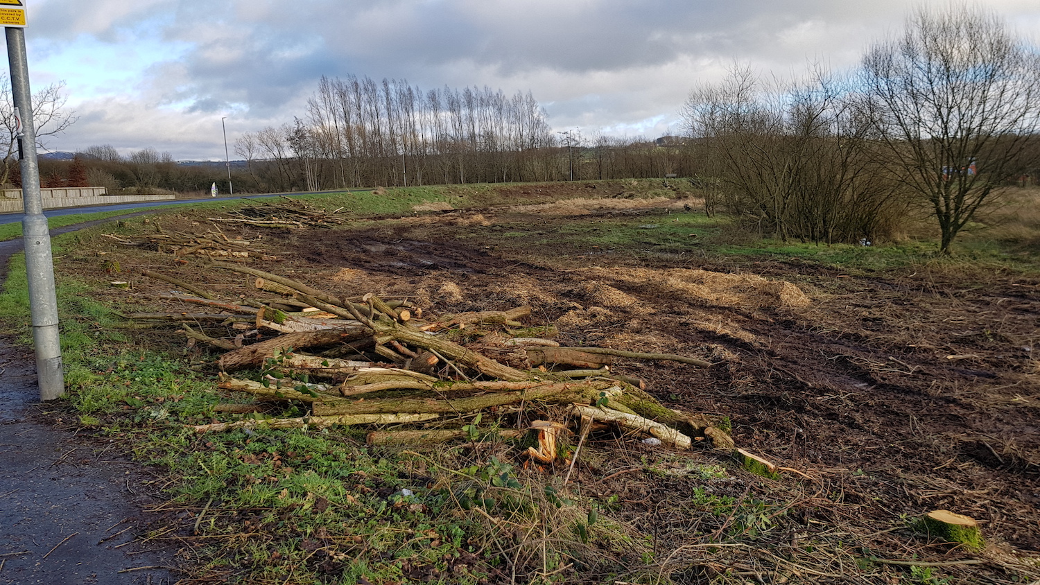
Pic 1: This is the loop at the very northern end
of the scheme ( here),
on what is currently the access road to the Ecos
Centre, on 25 Feb 2020. Trees and brush have
been removed here because the curve is being
reduced in severity by going offline slightly,
as shown in the map below. [Ian Hunter]
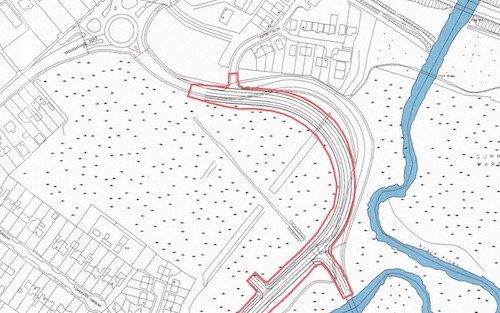
Pic 2: Map of the proposed route of the new road
at the very northern end. The picture above was
taken from roughly the top left end of the red
area. You can see how the intention is for the
new road to take a less tortuous bend round this
curve [DFC map].
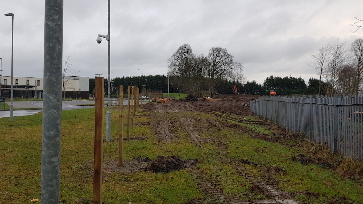
Pic 3: At the southern end of the scheme, this
is site clearance work underway in the grounds
of Castle Tower School ( here)
on 25 Feb 2020, looking north. Its existing
boundary is on the right, and the new boundary
is the wooden fence being built on the left.
This part of the road is a new-build, though it
extends and upgrades the existing access road to
the school behind the camera. [Ian Hunter]
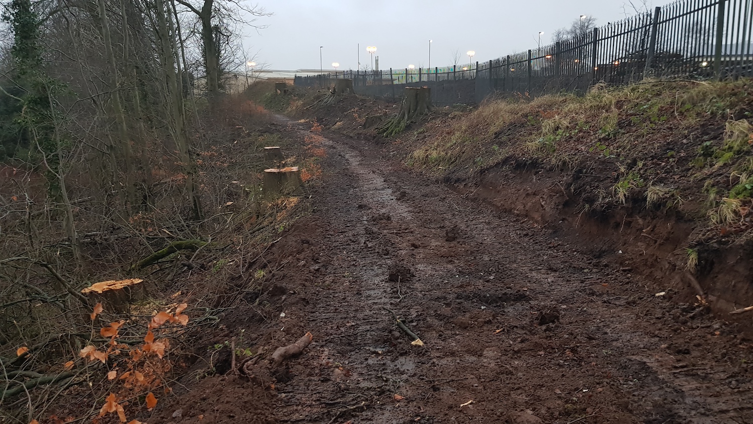
Pic 4: Continuing forward into the view in pic
3, and then turning round to look back south
again with the school behind the fence on the
right. The building in the distance is the
cinema. The works here unfortunately involve
felling a number of mature trees ( here),
which has now been completed, while the woodland
on the left remains intact. The new road will
run along the line visible here. 25 Feb 2020.
[Ian Hunter]
27 Dec 2018: The ISNI web site had
indicated that this scheme would go out to
tender in autumn 2018 but that did not happen,
probably because of the interregnum at Stormont.
The site has now been updated
to state that the scheme will go out to tender
in December 2019 with construction then
due to take place between March 2020 and March
2021. It should be noted that this, too, is
probably contingent on a return to Stormont so I
would not regard it has a particularly
meaningful timescale at this point. The scheme
also seems to be broken down into two components
- the "northern link road", connecting to the
A42, and the "southern link road", connecting to
the A26. It is possible therefore that the link
road may be constructed in phases.
|

