Status |
Construction scheme (completed) |
Where |
Bypasses the town of Newtownstewart, a bottleneck on the A5 Omagh (and Dublin) to Londonderry road. |
Total Length |
2.6km / 1.6 miles |
Dates |
Work began August 2001
Opened 17 December 2002 |
Cost |
£8.2 million |
Photos |
See below |
See Also |
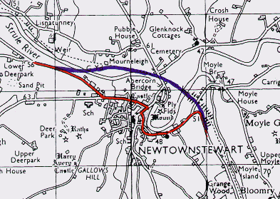
General area map (prior to construction of bypass).
|
The small town of Newtownstewart is set in a beautiful location on the side of the River Strule/Mourne, which becomes the Foyle and flows through Derry. The A5 from the south curves round a headland over the valley to enter the town. However, with mounting traffic volumes, the level of noise and pollution in the town became unacceptable and the Roads Service announced the construction of a bypass in May 1998. Work on site began in August 2001.
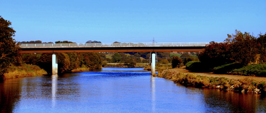
The route chosen was that of the former "Derry Road" railway line - to cross the river at the east of the town onto the east bank, and then re-cross it again on the north side. The road thus includes two especially slender steel girder bridges, which are the largest of their kind anywhere in Northern Ireland and are designed to blend into the surrounding scenery. The A5 route was being substantially upgraded at this time with simultaneous bypasses being built through Omagh and around Strabane.
Photos / Maps

The route of the Newtownstewart Bypass [Roads Service].

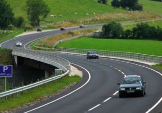
The Newtownstewart Bypass seen looking east from the western end. This photo appeared in the Roads Service "On The Move" magazine of issue 6, Summer 2006.

Another view of the bridge over the Strule. [Mark Neeson]

The same bridge shown in the previous photo seen from the north side.
[Photo by CEEQUAL, http://www.ceequal.com/award4.asp]
|

