|
This page contains an archive of updates about
progress on this scheme up to 7 April 2014. More
recent updates can be found here.
Progress
7 Apr 2014:
This update is to bring you nine photographs
that were taken by Owen Fulton on 31 March -
thank you! In my previous update below I got
slightly ahead of myself in terms of the
progress on the new northbound carriageway,
apologies! What we can say is that the kerbing
and street lighting seems to be in place for the
new northbound carriageway from the south end of
the scheme at Jordanstown to around Neill's
Lane although traffic is not yet using it.
At the main Station Road junction the road
widening seems to be completed, but the
roundabout is not yet in place. This junction
will apparently be closed for two weeks at the
end of April, which may be to facilitate works
of this nature. This will cause disruption as
there is no other way out of Greenisland village
onto the Shore Road without going on a several
mile detour. I haven't got many photographs of
the 'offline' section at the northern end of the
scheme, as it's hard to get a vantage point, but
I'm told that some of the kerbing is now in
place. The bridge that will carry Whinfield Lane
over the new dual-carriageway now has one
both of its beams in place. The photographs
below are arranged in order from south to north,
starting at the Jordanstown end of the scheme.
In most cases I've also linked to a Google
Streetview of the same view before work began.
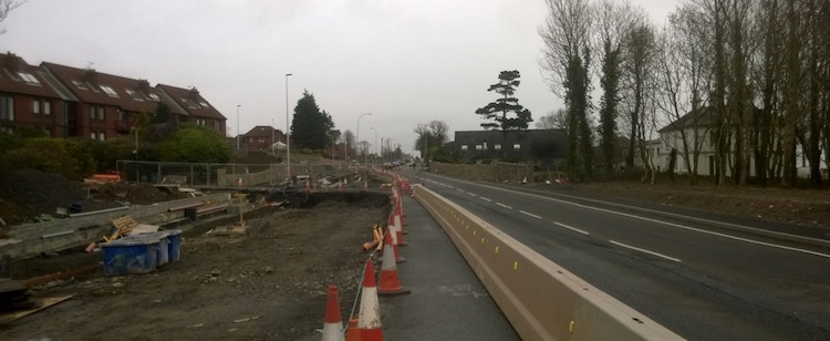
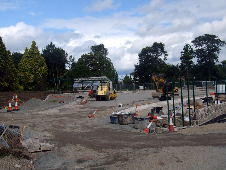
Pic 1: View north east along Shore Road at the
very south end of the scheme on 31 Mar 2014. The
entrance to the University of Ulster is on the
left beyond the flats on the left. Same
view before work began. [Owen Fulton]
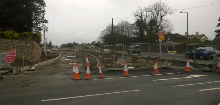
Pic 2: Looking north east along the future
northbound carriageway from what will be the
middle of the future roundabout at the
University of Ulster on 31 Mar 2014. The future
road is taking shape here. The traffic on the
right is on the original Shore Road which will
later be reconstructed to become the southbound
carriageway. Same
view before work began. [Owen Fulton]
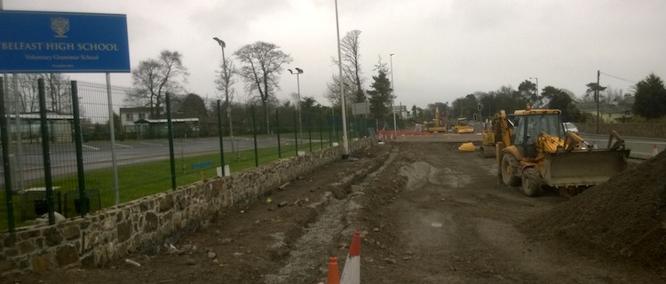
Pic 3: The view north east along the future
northbound carriageway beside Belfast High
School on 31 Mar 2014. The line of grey gravel
in the centre of the frame is probably for
drainage pipes, or possibly kerbs. [Owen Fulton]
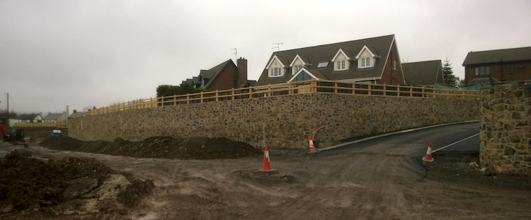
Pic 4: Near Shorelands (the houses straight
ahead) are some houses whose driveways
previously went directly onto the Shore Road
(off frame to the right, see next photo). This
is now deemed inappropriate, so this new access
road was nearing completion on 31 Mar 2014. Same
view before work began. [Owen Fulton]
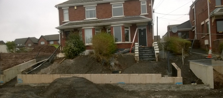
Pic 5: Two of the houses which were previously
accessible from the Shore Road on 31 Mar 2014.
These houses will now be accessed from the rear,
using the access road shown in Pic 4, so their
driveways have been walled off. Same
view before work began. [Owen Fulton]
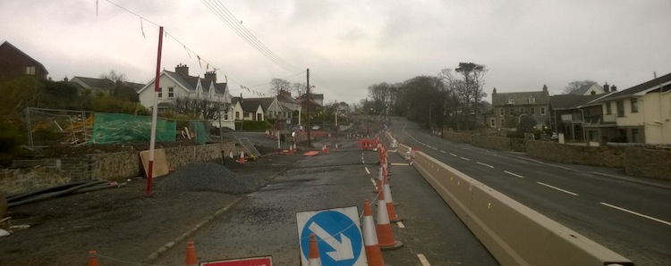
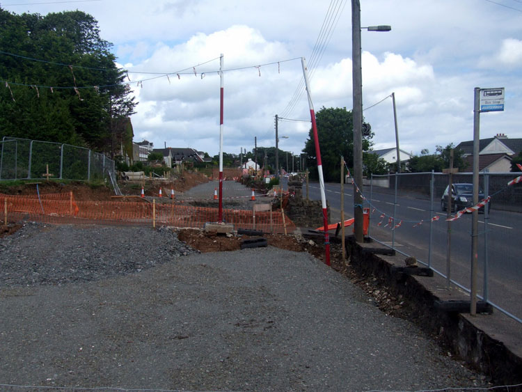
Pic 6: The view north east along Shore Road from
near the same location as Pic 5, on 31 Mar 2014.
Work on the future northbound carriageway is
only just getting underway now with traffic
being shifted onto a temporary road surface on
the right. Same
view before work began. [Owen Fulton]
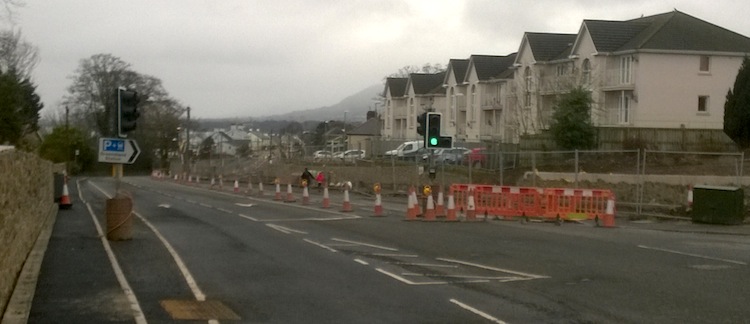
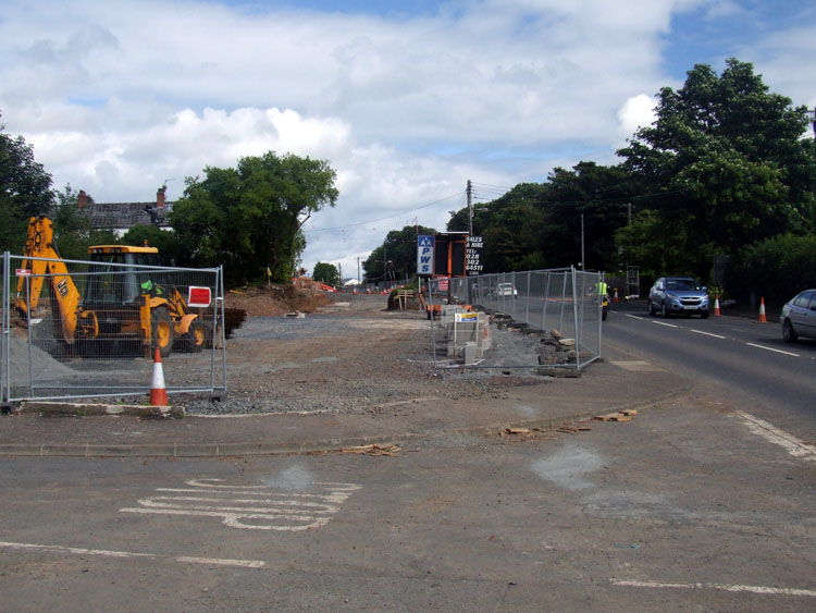
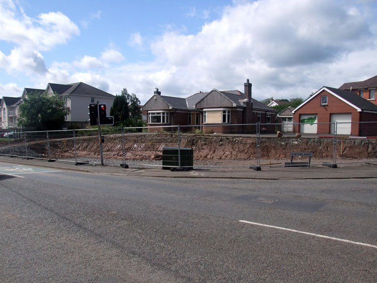
Pic 7: View south west (towards Belfast) on
Shore Road from the Station Road junction on 31
Mar 2014. The work to widen the site here, ie by
building new boundary and retaining walls,
appears to be complete with work soon to focus
on constructing the new signalised roundabout. Same
view before work began. [Owen Fulton]
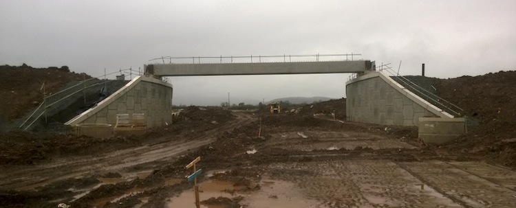
Pic 8: Whinfield Lane bridge with one beam in
place on 31 Mar 2014. There is no sign yet of
the road underneath being constructed, although
site clearance and leveling works seem well
advanced. Same
view before work began. [Owen Fulton]
Pic 9: At the north end of the scheme this is
Seaview, the point where the offline section of
dual-carriageway will rejoin the existing Shore
Road (behind the camera) at a new roundabout.
The PSNI station is on the right. Here seen on
31 Mar 2014, work is still at an early stage
with culverting works apparently underway on the
right. Most effort is probably being given to
the 'urban' sections which are much more labour
intensive. Same
view before work began. [Owen Fulton]
25 Mar 2014: Unfortunately I haven't got any
recent photos of this scheme, but work appears to
have progressed very well over the past four
months. The original schedule said that the
northbound carriageway would be constructed first,
being completed during the spring of 2014. As
expected, the northbound carriageway is indeed
taking shape and traffic has been diverted onto it
in at least two locations temporary
sections of tarmac to facilitate this - at
Shorelands and at Station Road in the middle of
Greenisland. I hope to get some photos during
April. With thanks to Andrew McKeever and Andy
Boal for information for this update.
8 Dec 2013:
These photos were taken just under a week ago by
by Owen Fulton (many thanks!) and show progress
on the new road. A lot of work has taken place
on retaining walls since the last update. As
anticipated in the previous update, the concrete
retaining walls do indeed seem to be being faced
with stone for aesthetic appeal. Since so much
work is going on on retaining structures at the
minute, it seems likely that the contractor will
be in a position to start constructing the
actual future northbound carriageway soon. The
timetable given at project commencement said
that the northbound carriageway would be
completed by "summer 2014". In a few places
traffic has now been diverted wholly or partly
off the current road and onto widened sections,
which may be the start of this (see pic 1).
Drivers should exercise caution going through
the works due to the changing nature of the site
- there were a couple of incidents at the
entrance to the University of Ulster campus last
week.
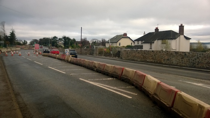
Opposite Belfast High school (which is to the
left here) traffic had been moved off the
existing Shore Road onto what will be the
southbound carriageway, on 2 Dec 2013, to allow
works on the future northbound carriageway in
the foreground. Similar
view before work began. [Owen Fulton]
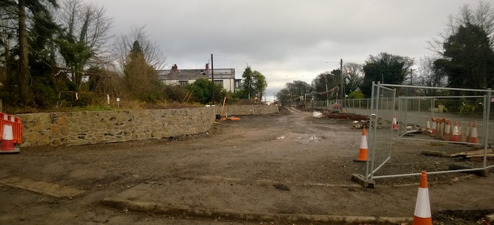
View north east at Silverstream Banks where the
retaining wall at the new bus layby for Belfast
High School has been faced with attractive
stone. 2 Dec 2013 [Owen Fulton]
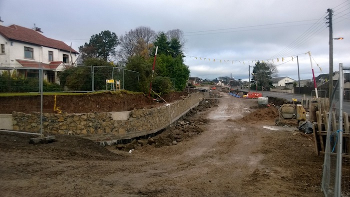
Retaining wall at Neill's Lane also being faced
with stone on 2 Dec 2013. Similar
view before work began. [Owen Fulton]
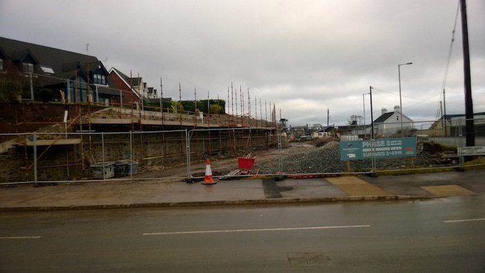
The very large retaining structure at Shorelands
has been significantly improved by the addition
of stone facing, here seen on 2 Dec 2013. Same
view before work began. [Owen Fulton]
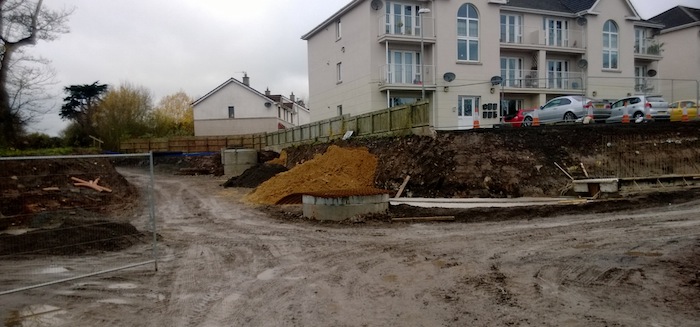
These apartments on Shore Road just south of
Station Road have had their embankments cut back
on 2 Dec 2013. Foundations for retaining
structures here are visible on the right. The
dirt road on the left will give rear access to 8
properties that currently front onto the
existing road to the left here. View
before work began. [Owen Fulton]
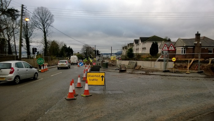
View south west along Shore Road on 2 Dec 2013
at the Station Road junction in Greenisland. On
this day the lights were out of action to
facilitate a lane closure. Eventually there will
be a compact signalised roundabout here. View
before work began. [Owen Fulton]
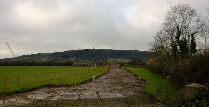
View north west along the future route of Whinfield
Lane (which currently runs beside the
trees on the right) on 2 Dec 2013, leading
towards the embankment and bridge that will take
it over the inland part of the dual-carriageway
ahead. [Owen Fulton]
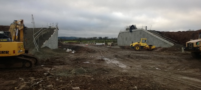
View south west from the existing Whinfield Lane
of the bridge that is being built to take it
over the future dual-carriageway. Seen on 2 Dec
2013. Same
view before work began. [Owen Fulton]
28 Oct 2013: These
photos were part of 8 taken by
'GreenislandRoads' on 5 October and uploaded to
his
photostream. Due to family illnesses I
have only now got a chance to stick these up. So
please bear in mind that they show progress as
it was three weeks ago, and work is likely
advanced further since then. As before, these
start at the Belfast end of the scheme and move
towards Greenisland.
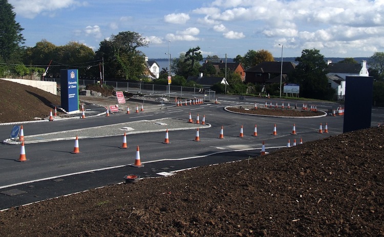
Pic 1: The roundabout at the entrance to the
University of Ulster Jordanstown campus is now
completed and looking very shiny and new.
However it is operating as a conventional
T-junction for the time being. 5 Oct 2013 [from
GreenislandRoads]
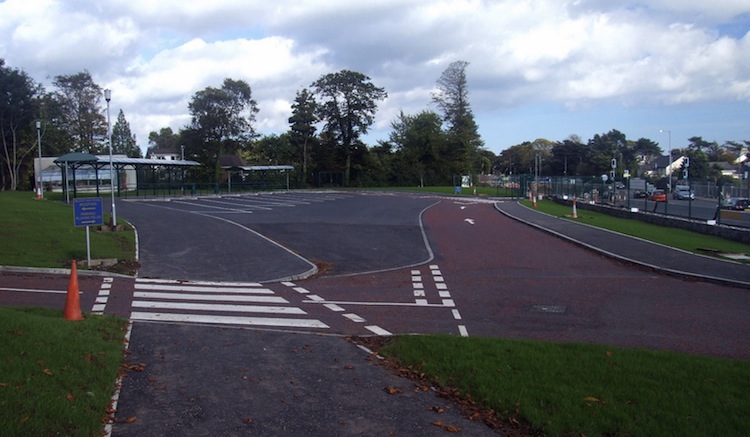
Pic 2: The now-completed drop-off facility at
Belfast High School on 5 Oct 2013 which was
completed during the summer to make sure that no
work had to be carried out during the school
term. [from GreenislandRoads]
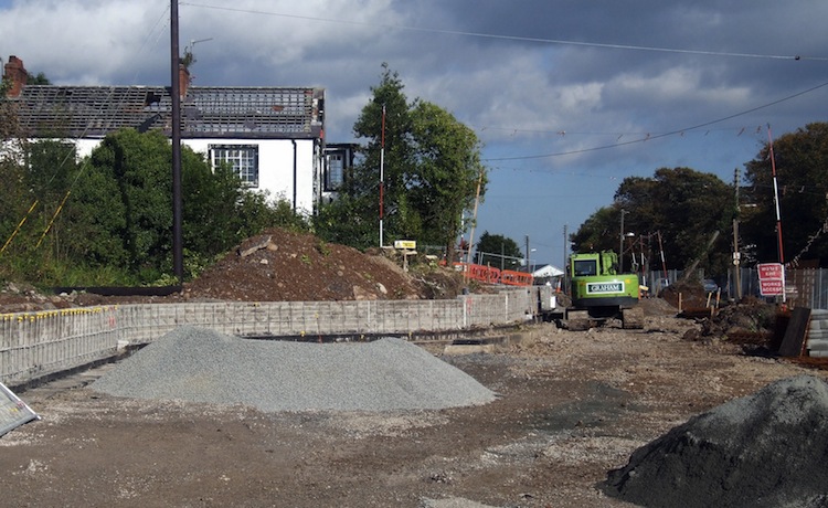
Pic 3: The view north-east near Silverstream
Banks on 5 Oct 2013 where a new, low retaining
wall is being built around the bus layby outside
Belfast High School. The building beyond looks
like it might need a roof tile or two
replaced... [from GreenislandRoads]
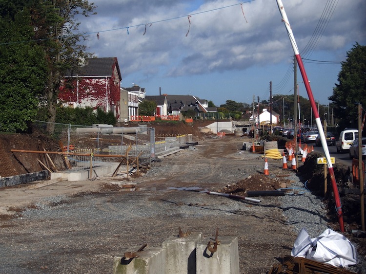
Pic 4: The view north east from near Oldstone
Close on 5 Oct 2013 where the future northbound
carriageway is taking shape in a very confined
space. [from GreenislandRoads]
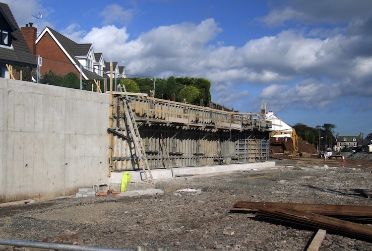
Pic 5: At Shorelands, where a steep bank had to
be cut back to make way for the new road, a
significant retaining structure was being built
on 5 Oct 2013. This will presumably be faced in
a more aesthetic material such as brick. [from GreenislandRoads] 22 Sep 2013:
This update is to bring you some new photos
taken just under a week ago by Owen Fulton. The
roundabout at the University of Ulster entrance
is "completed" in the sense that the road base
has been built, surfaced and the central island
mostly put in place. However the existing Shore
Road still passes through one side of it, so
it's not yet functioning as a roundabout and is
instead being treated as a conventional
T-junction (see pic 1). The new entrance to
Belfast High School was successfully completed
in time for the new term (see pic 3). Now that
earthworks on the online section seem to be
largely done, work currently seems to focus on
installing new boundary walls, retaining walls
etc (see pics 2, 4, 7), although there are some
very obvious service diversions that still need
done (see pic 6). To their credit, the
contractor has also been attaching window art to
the windows and doors of the many derelict homes
along the site (see pic 5) which gives them the
impression of being happy, occupied homes and
lifts the whole mood of the site. A nice touch.
The photographs below were all taken between
Jordanstown and Greenisland and are arranged in
order starting at the Belfast end of the scheme.
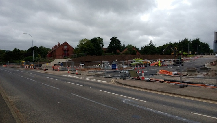
Pic 1: Completed University of Ulster entrance
around 17 Sep 2013, showing the future
roundabout island now in place, although
it's marked out as a T-junction for the
time being with the Shore Road passing through
one side. [Owen Fulton]
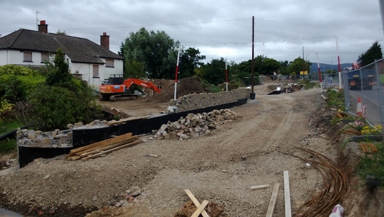
Pic 2: New boundary walls being built to
reinstate boundaries for the new, wider road.
Seen around 17 Sep 2013 looking south west near
Langley Hall. This
is the same view before work began. [Owen
Fulton]
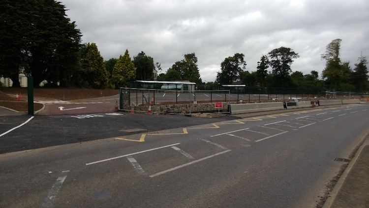
Pic 3: The completed entrance to Belfast High
School seen in early Sep 2013. The stone wall is
the future road boundary, while the metal
barrier is the current boundary. The widened
road will eventually run right up against the
stone wall. [Owen Fulton]
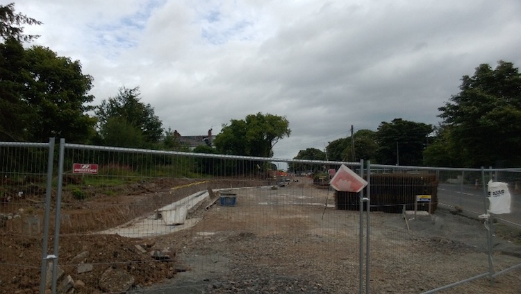
Pic 4: View north east along Shore Road from
close to Belfast High School. This will be a
future bus stop layby. 17 Sep 2013 [Owen Fulton]
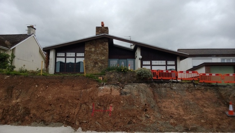
Pic 5: A derelict home near Shorelands that has
been made to look much nicer with the addition
of window art, as seen around 17 Sep 2013. This
is the same house before work began. [Owen
Fulton]
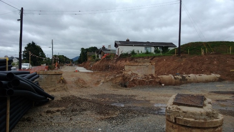
Pic 6: View south west along Shore Road from
Shorelands around 17 Sep 2013, showing not only
the line of the future northbound carriageway,
but also some service diversions that still have
to be done. [Owen Fulton]
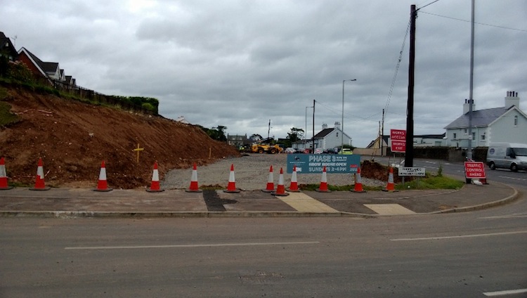
Pic 7: View north east along Shore Road from
Shorelands showing the completed earthworks that
have cleared the way for the future northbound
carriageway around 17 Sep 2013. [Owen Fulton]
4 Sep 2013: An
extra update to bring you two more pictures,
this time of the works at the University of
Ulster at Jordanstown entrance onto the
Shore Road (map).
They are used with permission from
'GreenislandRoads' who has shared these plus 10
more taken at the same location on or around 31
August over on
his photostream. The entrance has been
closed for the whole summer to allow for major
earthworks. These involve digging out a large
area of the land at the entrance to make way for
the future roundabout. It's unclear whether an
actual roundabout will be constructed prior to
the entrance opening again in time for the new
university term at the beginning of October, or
whether it will be limited to the earthworks. As
you can see, parts of the excavated land are
being finished off with slopes, and parts with
retaining walls.
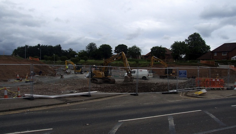
Pic 1: Looking north towards the UUJ entrance
from Shore Road on/around 31 August 2013. You
can see the original traffic island from the
entrance under the squashed "keep left" bollard,
which looks like it's been run over by a digger.
This is the
view before work began. [from GreenislandRoads]
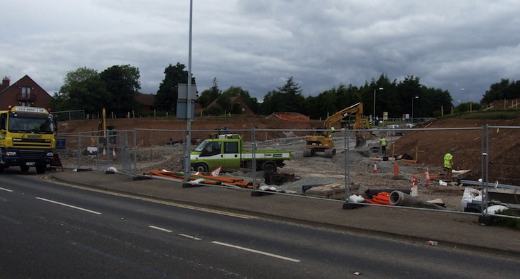
Pic
2: Looking west towards the UUJ entrance from
Shore Road on/around 31 August 2013. This whole
area was once a grassy slope as you can see from
the view
before work began. [from GreenislandRoads]
21 Aug 2013:
Construction has now been underway for a little
over 4 months, and already the route of the
future road is very obvious from ground level.
With site clearance work now basically done,
work over the past couple of months has focused
on preparing the foundations on the land that
has been cleared. However, during July and
August there has been a particular focus on the
University of Ulster entrance, and the Belfast
High School entrance, both of which are being
reconstructed in earnest during the time that
the two institutions do not have students. The
seven images below are all used with permission
from 'GreenislandRoads' who is sharing these
along with a few others I have not reproduced
over on
his photostream. My grateful thanks to
him. The pictures are arranged in order starting
at the Belfast end of the scheme and heading
towards Carrickfergus. (Last month I widened the
pages on the site, so these are the first images
at the new, larger size - enjoy).
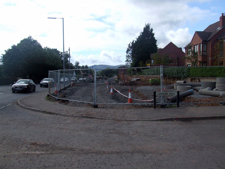
Pic 1: Looking towards Belfast from Langley Hall
on 18 Aug 2013, the road base is soon to get
underway with components for the drains visible
on the right. No demolition was required here,
due to forward-thinking at the time Langley Hall
was built, as you can see from the
view before work began. [from GreenislandRoads]
Pic 2: This view on 18 Aug 2013 shows the
entrance to Belfast High School being
reconstructed to make way for the new road. The
contractors have worked flat out over the summer
holidays to ensure that this work is done before
the school term begins. This is
the same view before work began. [from GreenislandRoads]
Pic 3: At Silverstream Banks, here looking along
the existing Shore Road towards Carrick on 18
Aug 2013, the line of the new northbound
carriageway is very obvious. This is
the same view before work began. [from GreenislandRoads]
Pic 4: Moving further north, this is the view
along the future northbound carriageway on 18
Aug 2013. The existing Shore Road, on the right,
will eventually become the southbound
carriageway. Shots like this illustrate just how
litle space the contractor actually has to carry
out the work. This is
the same view before work began. [from GreenislandRoads]
Pic 5: At the junction of the Shore Road and
Station Road in Greenisland village on 18 Aug
2013, excavation seems to have only recently
taken place. The houses behind are unoccupied
but will not be demolished. This is
the same view before work began. [from GreenislandRoads]
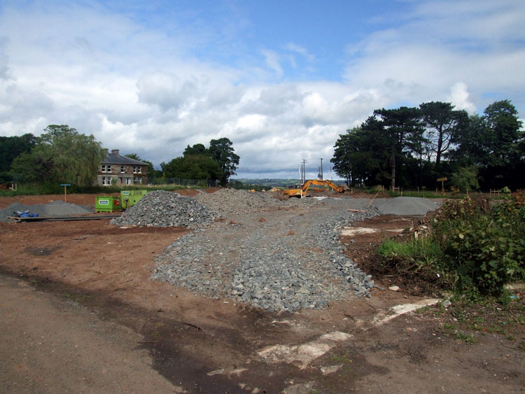
Pic 6: Just north of Station Road, the new road
swings inland away from the current Shore Road.
This is the view from the former Spar shop site
on 18 Aug 2013 showing aggregate being laid for
the road base. This
is roughly the same view before work
began. [from GreenislandRoads]
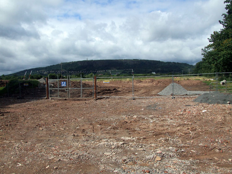
Pic 7: After travelling inland for about 1km,
the new road rejoins the existing Shore Road
beside the PSNI station. This is the view from
the Shore Road here on 18 Aug 2013, with the
route of the future road heading away towards
the left beyond the fence. This is
the same view before work began. [from GreenislandRoads]
2 Jul 2013:
A quick update just to make you aware of this
Flickr set of images, taken 2 or 3 days
ago by @ppdoddy.
The first 6 are a nice sequence of before and
after picture pairs taken at (roughly) the same
location two weeks apart. The images show the
progress that continues to happen in absorbing
the land that has been vested from adjacent
properties into the site. Some of the images
show houses that are clearly not inhabited, but
yet have not been demolished. These are
properties are probably ones that were either
purchased under blight legislation and boarded
up, or have been recently vested and have been
sealed temporarily, but which will eventually be
re-sold (at reduced price) once the scheme is
completed. It is my understanding that all
properties that were to be demolished have now
been demolished. With thanks to @ppdoddy
for taking the time to share these images.
23 Jun 2013: Progress
on the scheme has been good over the past month.
All property demolition seems to be completed,
and actual earthworks are well advanced. Now
that the spring term is over, the University of
Ulster entrance, which will be converted from a
priority T-junction to signalised roundabout,
has been closed and will remain so until around
September. You can see this in the first of the
photos below, which are provided thanks to a
contributor who wishes to remain anonymous. The
rest of the images follow a progression from the
Belfast end of the scheme to the Carrick end of
the scheme.
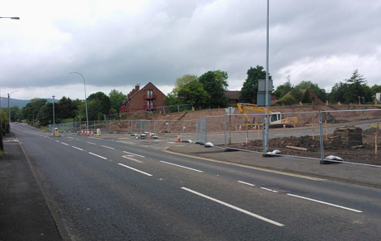 Pic 1:
 The entrance to the University of
Ulster which has been closed so that the
earthworks for the future signalised roundabout
can take place. 18 June 2013 [Anonymous
visitor].
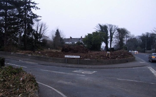
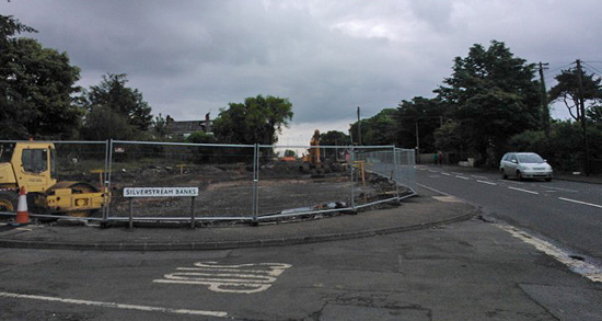 Pic 2:
 All the vegetation and land
clearance at Silverstream Banks are now
complete. This
is the same view before work began. 18
June 2013 [Anonymous visitor].
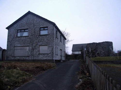
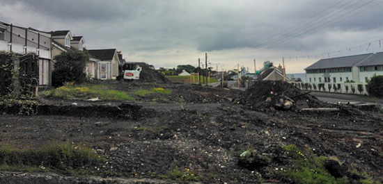 Pic 3:
 The view north-east from Castle
Lug, a medieval tower house just before
Greenisland with vegetation removed. These
houses will remain. 18 June 2013 [Anonymous
visitor].
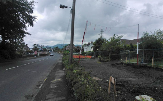 Pic 4:
 The view south-west, towards
Belfast, from Station Road in Greenisland with
site clearance work well underway. This
is the same view before work began. 18
June 2013 [Anonymous visitor].
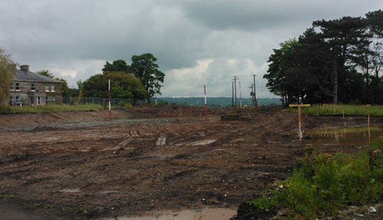 Pic 5:
 Turning the other way and stepping
onto the ground where the Spar shop used to be,
this is the view north east. This is where the
new road heads off inland away from the existing
Shore Road. This
is roughly the same view before work
began. 18 June 2013 [Anonymous visitor].
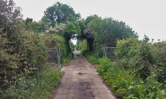 Pic 6:
 The new offline dual-carriageway
will cross Whinfield Lane, seen here looking
south east. The lane will be raised up on an
embankment and be bridged over the new road. 18
June 2013 [Anonymous visitor].
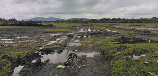 Pic 7:
 View south-west (towards Belfast)
from Whinfield Lane showing the route of the new
dual-carriageway taking shape on the right in
the form of wooden fence posts. This
is the same view before work began. 18
June 2013 [Anonymous visitor].
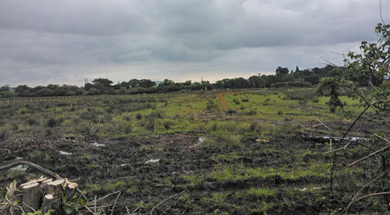
Pic 8: Turning 180° from the previous image,
this is the view north-east (towards
Carrickfergus) from Whinfield Lane showing the
route of the new dual-carriageway taking shape
on the left. This
is the same view before work began. 18
June 2013 [Anonymous visitor].
8 May 2013:
Three more photos this time, again taken with
permission from 'GreenislandRoads' who is
sharing these and future photographs of the
works on
his photostream. The pictures were taken
on 30th April, although I have only just got a
chance to update the page. Demolition work seems
to be progressing very well, with probably the
majority of houses slated for demolition now
gone and much vegetation clearance also
completed. The well-known Spar shop in
Greenisland was almost gone when the picture was
taken, while the adjacent house was a pile of
rubble at that point. I am also led to believe
that at least some of the building rubble from
the demolition is being recycled to be used as
fill for the construction of the new road. That
will provide an interesting challenge for
interpretive archaeologists in 300 years' time!
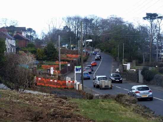 Pic 1:
 The view north-east along the
Shore Road (towards Greenisland) from Shorelands
on 30 Apr 2013 showing vegetation clearance
ongoing in a whole series of private gardens.
[from GreenislandRoads]
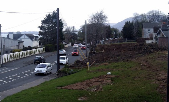 Pic 2:
 The view south-west (towards
Belfast) from the same location as picture 1 on
30 Apr 2013 showing the same idea - lots of
vegetation clearance. This area will presumably
require major earthworks in due course to lower
the side of the hill. [from GreenislandRoads]
 Pic 3:
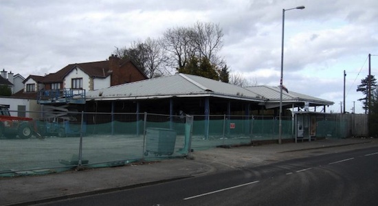
 The former Spar shop in
Greenisland being systematically demolished on
30 Apr 2013. This
is the same view before work began. This
is the location where the online upgrade (to the
left) will head off into the countryside
(straight ahead through the Spar in this view)
following an offline route for the rest of the
distance. [from GreenislandRoads] 15 Apr 2013: With
work underway now for about six weeks, the
nature of the work has become very obvious to
road users. At this stage work is focused on
site clearance. For example, most of the trees
at the entrance to Belfast High School have now
been felled. Many hedges and boundaries have
also been removed, revealing the once-hidden
houses behind. Many of these were apparently
unoccupied and boarded up, having been purchased
by the DRD under blight legislation over many
years, but screened from public view by trees
and hedges. Work has now begun on demolishing
these houses, and I include a selection of
images below with permission from
'GreenislandRoads' who is sharing these and
future photographs of the works on
his photostream. There is something quite
sad and haunting about these images. Work has
also now got underway to demolish the well-known
Spar
shop in Greenisland and the adjacent
house, which were very
much in the way of the road!
This house is adjacent to the one in the
previous photo, and is itself adjacent to Castle
Lug (or Cloch-na-Larty) the remains of a
medieval tower house that will not be disrupted.
This
is the same property before work began. 13
Apr 2013 [from GreenislandRoads]
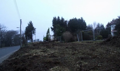
Vegetation clearance alongside the A2 (on right)
at Silverstream Banks to make way for the
widened road. This
is the same view before work began. 13 Apr
2013 [from GreenislandRoads]
Vegetation clearance alongside the A2 (on left)
to make way for the widened road. The exact
location here is uncertain. 13 Apr 2013 [from GreenislandRoads]
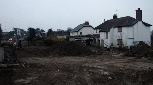
Demolition underway on two properties on the
sea-side of the Shore Road, opposite Belfast
High School. These
are the two properties shown. 13 Apr 2013
[from GreenislandRoads]
25 Mar 2013: The
DRD Minister officially "cut
the first sod" on this scheme last
Thursday, 21 March: a largely ceremonial event
that was unfortunately not widely reported in
the media. At the ceremony the Minister
reiterated the need for the road, and added "I
congratulate everyone involved in delivering
this scheme; Graham Construction, their
designer Roughan & O’Donovan, and all the
many local sub-contractors and businesses.”
11 Mar 2013:
A public meeting was held by the contractor
(not the DRD as I said below) on Tuesday 5th
March. 500 people turned up which is an
amazingly high turnout. You can download the
presentation and material here. At the
meeting local people were given a schedule of
work planned:
- March 2013 to Summer 2014: Northbound
carriageway between Jordanstown and
Greenisland
- Summer 2014 to Spring 2015: Southbound
carriageway between Jordanstown and
Greenisland
- Spring 2013 to Spring 2014: Offline section
between Greenisland and Seapark
As you can see, the plan seems to be to complete
the northbound carriageway first. Since the
current road sits partly on top of the site of the
future northbound carriageway, this is going to
mean some strange bends and curves as time goes on
to allow traffic to weave and thread its way
around the various parts of the work site. The
southbound work that follows ought to be simpler
as all current traffic will then be able to be
accommodated on the completed northbound
carriageway. Work on the offline section of road
between Greenisland and Seapark will have much
less impact on traffic as it does not affect the
existing road except at either end. In other news
, some tree felling was reported in the vicinity
of Belfast High School on Friday. With thanks to
Andrew McKeever for the above. It has to be said
that the contractor has gone very far in setting
up a dedicated
web site, e-mail
address and phone number for those with
questions or concerns about the scheme. Great to
see.
3 Mar 2013:
Work is due to get underway on this scheme on
Tuesday, 5th March 2013. On the day prior to
this, Monday 4th March, Roads Service have
organised a public meeting at the Clarion
Hotel, Carrickfergus from 7pm-9pm. This is
presumably to get residents and road users up to
speed on what is about to happen. They have also
released an information leaflet for the same
purpose, available here.
The leaflet includes a commitment to road users
that the road will have one lane open in each
direction (as it does now) between 6am and 8pm
on week days. In other words, any road closures
will not happen during the working day. The same
commitment applies on Saturday 8am-7pm and
Sunday 10am-7pm. It will be wonderful to see
this scheme finally underway after so many years
of waiting. If anyone happens to take photos of
the works underway I would love to see them! You
can tweet them citing @niroads, or e-mail them
to me (see "contact" on left). Roads Service's
official web page about the scheme is here.
31 Jan 2013:
Graham Construction was today
appointed as the contractor for this
scheme. This is earlier than the expected date
of 17 February, but welcome nonetheless. It is
an historic event, as it finally marks the
commencement of a project that has been planned
since at least 1969 - a period of 44 years. Work
will apparently get underway in March, although
it will take a month or two for the contractor
to properly mobilise and set up their site
yards, etc. The whole project is expected to
take a little over two years to complete, the
whole road should be finished by the summer of
2015. Remember that, as outlined in the previous
update, the St
Bride's park-and-ride/share car park at
Carrickfergus railway station will be free
of charge for the duration of the works
and is well worth trying out. (I will leave this
scheme in the "forthcoming" list until work
actually begins in March.)
8 Jan 2013:
It is an exciting time for supporters of this
scheme - a scheme that has been proposed in one
form or another for almost half a century - as
we are now only 3 months away from commencement!
According to this
news story in Newtownabbey Today, the DRD
has received six tenders for the construction of
this scheme. It is expected that the contractor
will be appointed on 17 February, ie six weeks
from now. The news story also says that the work
is due to get underway "two months later", which
would be April. There will need to be a
"mobilisation" period while the contractor comes
on site, sets up site yards etc, so we could
expect to see major work taking place by the
summer. The same news article stresses local
concerns about congestion during the works.
However, given that the road is currently one
lane each way, and will remain so at busy times
throughout the works, there is little scope for
things to get much worse. Nevertheless, the
"Roads" Minister has taken the wise precaution
of making the St Bride's park-and-ride/share car
park at Carrickfergus free
of charge from yesterday until the scheme
is completed in the summer of 2015. This will
make it cheaper to get the train into Belfast or
car share, so is a welcome measure. In fact,
given the importance that is now placed on
encouraging alternative forms of transport, one
could argue that all park-and-ride sites should
be free of charge.
24 Oct 2012:
The BBC is reporting
today that the Vesting Order for this scheme has
been, or is about to be, published, although
this has not appeared on the DRD web site. The
Vesting Order is the legal document that is
required to compel landowners to sell the
property needed for the scheme to the DRD. Quite
a few properties have already been acquired
under "blight" legislation, which requires the
DRD to purchase a property if the owner cannot
sell it due to a planned future road scheme. In
the update of 5 June 2011 (below) I reported how
25 properties had by then been purchased under
blight legislation, and that the remaining
properties that will be acquired via the Vesting
Order were then worth around £17m. The Vesting
Order is published late on in the planning
process as it requires the DRD to actually have
the necessary cash, which was only made
available in February of this year. The
construction contract is due to be awarded in
February, with work to get underway in earnest
by June 2013.
30 July 2012:
According to an internal memo from last February
which has been published
on the DRD web site, the timetable for the
procurement process is as follows. Tender
documents issued 11 June; Tenders returned by 5
Nov 2012; Award decision issued 8 Feb 2013;
Award contract 17 Feb 2013. It also clarifies
that the £57m budget will be spent £3m 2012/13
financial year; £25m 2013/14; £25m 2014/15 and
£4m 2015/16. The current anticipated completion
date is "end June 2015". However, the document
does refer to a 4 month "mobilisation" period
before construction begins, presumably meaning
the period for the contractor to bring their
resources to bear on the project, setting up
site yards, etc. Thus intensive work on the
ground would likely not begin until June 2013.
24 Jun 2012:
Stage one of the procurement process should now
be complete (see previous update). According to
the EU
tender notice, the shortlisted contractors
were sent invitations to participate in stage
two on 11th June. This second process will see a
winning contractor selected, hopefully by the
end of 2012, with work scheduled to begin on the
ground in early 2013. Although nothing is yet
happening on the ground, the wheels of progress
on this scheme are greased and are now moving as
fast as they can!
13 Mar 2012:
Following February's announcement, Roads Service
have lost little time putting this scheme out to
tender. The tendering process will be done in
two stages. The initial stage is just to compile
a list of companies that Roads Service are
confident could
do the work. The second stage will be the formal
tender, where one contractor will be selected.
The advertisement
for the initial stage went live on 1
March, and the selected companies will be
notified on 11 June 2012. This will then be
followed by the second stage, which ought to see
a final contractor selected before the end of
2012, with work to begin on the ground early in
2013. The scheme has already passed its public
inquiry and is good to go - it is only the
necessity to go through this tendering process
that means work can't begin straight away. (This
problem does not affect the A5 and A8 schemes
since they were done differently, with the
contractors appointed during the design stage).
14 Feb 2012:
Today saw a major
announcement about how the money freed up
by Dublin's postponement of money for the A5.
Perhaps the least-surprising element is that
this scheme will now go ahead. It was within
days of going out to tender in January 2011 when
it was put on hold. As a relatively cheap scheme
(compared to the A5, A6 and A8) it was the most
obvious scheme to get the go ahead, and this is
what has happened. The scheme has already passed
its Public Inquiry (held in 2007), so that is
not an obstacle. However the procurement process
(to appoint a contractor) has not happened, so
this will take some months. This is probably the
reason that the scheme is now due to go to
ground "early in 2013". With an estimated
timescale of two years, this means that the road
could be complete and in use by Spring 2015. The
people of Carrickfergus will be celebrating
tonight. In terms of cost, the DRD
press release gives the cost as vaguely between
"£50m-60m", whereas the OFMDFM
press release gives it more specifically at
£57m. The latter figure is very close to the
figure of £55.2m previously quoted by DRD, so I
am assuming it is correct.
12 November 2011:
Last Wednesday's announcement that the Irish
government was delaying its promised £400m
towards the A5 means that the A5 now cannot
proceed on the timescale envisaged, ie before
2016. This has created confusion as to how
Stormont's cash that has suddenly been released
should be spent. There are lots of road schemes
in planning, but due to the length of time the
legal processes take, only four schemes could
proceed in the near future. These are the ones
that have had their public inquiries and are:
- A2 dualling Greenisland (ie this scheme)
- A6 dualling Randalstown to Castledawson
- A8 dualling to Larne
- and of course, the big A5 scheme that is now
on the long finger.
It is therefore the first three of these that I
believe have the highest chance of proceeding
soon, and thus I would not be surprised if the
coming months see movement on the Greenisland
scheme.
5 June 2011:
This scheme was the subject
of an "adjournment debate" in Stormont
(the first of the newly elected Assembly) which
was held on 30th May. During this various
politicians from East Antrim and further afield
expressed their dissatisfaction with the sudden
halt that was called to this scheme in January.
In particular they highlight the problem of blight.
Under blight legislation (designed to prevent
people being stuck with an un-sellable house for
years and years) Roads Service had already
bought 25 properties and some of these have been
demolished. During the debate the new "Roads"
Minister Danny Kennedy explained in some detail:
"Consultations with affected landowners to
finalise and agree accommodation works were
also substantially completed in 2010. My
Department is, therefore, in a position to
complete the final statutory vesting order as
soon as finance becomes available. The
compulsory purchase of land for the scheme is
currently valued at £17 million. My
Department’s Road Service has acquired 25
residential properties under blight
legislation. A number of those properties have
been demolished in order that they do not
become derelict and vandalised. Any surplus
land or property not required for the scheme
will be declared surplus and disposed of on
the open market. That is normally carried out
upon completion of the scheme. However, my
Department’s Road Service is considering early
disposal of some properties in order to
minimise security and maintenance issues
associated with them. In the meantime, every
effort is being made to secure and maintain
all acquired properties."
While the new Minister
has committed to reviewing the A5 scheme once
the public inquiry has reported, he has not
offered any immediate hope for this scheme. All
he said was: "Schemes such as the A2 Shore
Road tend to take more than one year in
construction, and funding in year 5, and
possibly beyond, would be required before I
could give approval for construction to
commence. The funding in those years will not
become clearer until further work has been
completed to develop the third edition of the
investment strategy for Northern Ireland,
which, I understand, is due to conclude later
this year." So it's a case of "watch this
space".
14 May 2011: On Friday the
d'Hondt system of sharing Ministries in the
newly convened Northern Ireland Assembly
resulted in the Department for Regional
Development Ministry (which includes roads)
falling to the Ulster Unionist Party (previously
it was held by Sinn Fein's Conor Murphy). Of
relevance to this scheme is that the UUP
election manifesto included a committment to "advocate
a refocusing on the need to commission the A2
project at Greenisland, rather than the A5
Western Transport Corridor" (UUP
2011 manifesto). This does not
mean that there will be an overnight change to
the timing of this scheme, but it does suggest
that the incoming minister will be more
sympathetic to the need for this scheme than the
outgoing one.
14 Jan 2011: In a Roads
Service Board meeting on 30 November 2010
it was revealed that the initial
pre-qualification tender process (which chooses
which companies will be allowed to tender for
construction) has now been completed. At the
same meeting the Board "granted approval for
tender documents to be released" which
basically meant that the scheme was ready for
construction. However, yesterday the DRD (which
includes Roads Service) published
their budget for the period 2011-2015 and
this has revealed that due to lack of money this
scheme has now been put on hold,
seemingly until at least 2015. This is very sad
news for the scheme, given that it has been
planned for decades and was probably only months
away from commencing.
11 Sep 2010: Roads Service are
keeping their cards close to their chest in
terms of when this scheme might go ahead (see
previous update). However I note that they have
just released
the initial tender for this scheme. This initial
tender is to allow interested engineering firms
to bid to be included in the more complicated
tender which could be released in a few month's
time. This two-stage process ensures that only
those firms who have a chance of winning the
tender can actually tender for it. This clue
suggests that construction may indeed be getting
underway in the near future.
21 Jun 2010: Over the past
year not much has happened on this scheme. A
geotechnical investigation was carried out in
2009 (exploring the type ground the road will be
built on) and an archaeological survey began at
the end of April, focusing on Castle Lug - the
medieval tower house that lies close to the
Shore Road. There has been speculation
in the media that the scheme is going to be
delayed. This has been confirmed to an extend by
Roads Service who are
now saying merely that "The start date
for this scheme will depend upon the
availability of funding in future years".
This effectively means that Roads Service no
longer knows when this scheme will be built. In
a debate
in the Assembly on 8th June, the DRD Minister
said "If the finances are available,
delivery is expected to start in 2011-12, and
the project should be completed in 2013."
However this seems increasingly unlikely to
happen as the financial situation deteriorates.
16 Jun 2009: The Regional
Development Minister provided an update
on this scheme in the Assembly on 5th June. The
Geotechnical Investigation (looking at ground
conditions on the proposed route) was carried
out from January to June 2009. Archaeological
work is due to be carried out during the Autumn
of 2009. The timescale has not really changed -
subject to the availability of funding (not a
certainty these days) it is planned to commence
in 2010/11 and be completed "by the end of the
2012/13 financial year", ie by April 2013.
24 Nov 2008: The press release
issued 7 weeks ago (see previous update)
suggested that work would begin in 2010 or 11.
When Roads Service met with Carrickfergus
Borough Council on 10 November this was revised
to 2011 at the earliest, as reported by The
Carrick Times. It quotes a Roads Service
spokesperson as saying that "With a fair
wind, construction will commence in 2011."
and "We are pushing this forward as
vigorously as we can; the slow bit has been
the statutory procedure, as a result of the
objections we received. Schemes compete and
are subject to availability of funding, but it
is of the highest priority within the eastern
division." The vesting order is due to
be published during 2009 with the project put
out to tender in 2010. This will lead, if there
are no problems, to work on the ground
commencing in 2011 and lasting about two years.
2 Oct 2008: Roads Service's
response to the public inquiry was published on
30th September. It did not say anything earth
shattering, and committed to proceeding with the
scheme largely as proposed. The documents, available
here, outline Roads Service's response to
the main concerns of the inspector (of the
public inquiry). These include a slight
realignment at Langley Hall to avoid vesting
land from properties that were only constructed
very recently and whose location had received
approval from Roads Service at the time. It also
modifies access to Belfast High School which
will now consist of a one-way system accessed to
and from the new road directly, and the
relocation of the pedestrian crossing. However,
a layby on the citybound carriageway has been
rejected on the grounds of safety and
cost/benefit analysis. The criticism that the
"online" nature of part of the scheme would not
allow for future road improvements on the road
was rejected by Roads Service on the grounds
that no specific improvements were currently
proposed. This viewpoint is in contrast to the
approach taken in the 1970s, when many roads
were constructed with additional capacity for
future improvements (eg M2 between j4 and j5).
The accompanying press release confirmed that
work is scheduled to get underway in 2010/11 and
last about two years.
22 Sep 2008: According to the
Regional
Development Minister, the results of the
public inquiry into the scheme are expected to
be published in October 2008.
28 Apr 2008: According to the
strategy document "Investment
Delivery Plan for Roads" of April 2008,
the start date for this scheme has been pushed
back from 2008/09 to 2010/11 with completion due
2012/13. This delay is probably due to cash
shortages caused by the promotion of schemes on
the A5 and A6 corridors, but will be
disappointing new for Carrickfergus commuters.
17 Nov 2007: In this
press release from October 2007, the cost
was given as £55.2m. This is another substantial
rise in costs. The scheme was included in the
Draft Belfast Metropolitan Area Plan in 2004 at
an estimated cost of £21m. By March 2006 the
cost had been revised and had doubled to £41m.
The further rise of about 30% over the past year
and a half probably reflects refinements in the
design and rises in property values. In the
design currently proposed, Greenisland's
medieval tower hosue, known as Cloch-na-Larty
will survive the scheme but will lose some of
the open land in front of it.
|

